High Barnet Place
High Barnet EN5

Local Planning Authority
London Borough of Barnet
Client
Barratt London
Architects
JTP Architects & Masterplanners
Consultants
Lichfields (Townscape & Heritage), Avison Young (Planning)
Visualisation Scope
17 AVR Level 1 (Wireline), 15 AVR Level 3 (Photorealistic Render)
Project Overview
High Barnet Place is a long, narrow site of about 1.45 hectares along the south western edge of High Barnet Underground Station. It currently holds surface car parking, self storage containers and industrial buildings, with a frontage to Barnet Hill that Lichfields describe as unattractive and inactive on the approach to Chipping Barnet. Part of the site is allocated for residential development under Site Allocation 37.
Application 25/2671/FUL proposes 283 homes and 609 square metres of flexible commercial floorspace at ground level, in five buildings of five to eleven storeys. The scheme was designed by JTP Architects and Masterplanners for a joint venture of TTL High Barnet Properties, London Underground, Places for London and BDW Trading, trading as Barratt London.
The site sits on the northern slope of the Dollis Valley and falls from about 116.7 metres above Ordnance Datum at the north western corner to about 98 metres at the south eastern end. The buildings step down with it. Building A, the Prow, is eleven storeys beside the station entrance, with a triangular footprint and an articulated brick crown. Heights reduce through the middle of the site to Building E, which marks the southern approach. The landscape proposals include a new Station Square, an improved pedestrian route through the woodland to the north west, and street tree planting along the Barnet Hill corridor.
Eighteen viewpoints were agreed for the assessment. Eye-kon produced the Accurate Visual Representations for the Townscape and Visual Appraisal prepared by Lichfields.
Planning and Heritage Context
There are no listed buildings on the site and it is not within a conservation area, but the surrounding heritage context is significant. The station building is Victorian and locally listed, a non-designated heritage asset that the development directly adjoins. Wood Street Conservation Area lies about 220 metres to the north west and takes in part of Chipping Barnet town centre. Nearby listed buildings include the Grade II* Church of St John the Baptist, the Grade II Tudor Hall, the Grade II Everyman Cinema in the former Odeon and the Grade II Church of St Mark.
Barnet has also identified a number of locally important views. One of these, Locally Identified View 4, looks out from King George's Fields across the intervening urban area towards central London. Lichfields found that the site does not lie in the direction of the protected view cone and recorded a nil degree of change to this view.
The existing site is largely hidden. In fourteen of the eighteen assessed views Lichfields record that it is not currently visible at all, and in the remainder it is glimpsed only through tree cover. Establishing where new buildings of this height would become visible, and by how much, was therefore the main task for the visual evidence.
As a tall buildings proposal the scheme was assessed against London Plan Policy D9 and the design policies of the Barnet Local Plan, across five townscape character areas and a viewpoint set reaching Totteridge to the south west and King George's Fields to the north. Lichfields concluded a range of nil to moderate beneficial visual effects, with no adverse effects recorded at any viewpoint.
Eye-kon's Involvement
Eye-kon produced 32 verified images across 18 viewpoints in support of the Townscape and Visual Appraisal prepared by Lichfields. The viewpoint locations were agreed with the council and confirmed by officers as appropriate.
Every viewpoint was covered in two seasons. Deciduous cover changes how much of a scheme of this height is visible, so the baseline was recorded on 15 October 2024 with the trees in leaf and again on 31 January 2025 with the branches bare. Winter represents the worst case and was covered at all 18 viewpoints. Summer was covered at 14. On views 5, 15, 17 and 18 the seasons make no material difference, or the proposal is already screened in winter, so no summer version was required.
Of the 32 images, 21 are AVR Level 1 wirelines and 11 are AVR Level 3 renders, all produced to Type 4 as defined in the Landscape Institute guidance. Five viewpoints change level between the seasons: a wireline in summer, and a render in winter when more of the buildings can be seen.
Production Process
1 | Photography and survey
Baseline photography was taken at all 18 viewpoints on a full frame 42 megapixel camera with a fixed 24 mm lens, tripod mounted and levelled at 1.65 metres above surveyed ground level. Both visits were made in clear weather with good visibility. Cropped versions equivalent to a 50 mm focal length accompany every view.
Camera positions and control points were surveyed to the Ordnance Survey National Grid and Ordnance Datum Newlyn using total station and sub-centimetre GNSS equipment, with 15 to 25 control points recorded at each viewpoint across the foreground, middle distance and background. Distances from the site range from 81.6 metres at the junction of High Street and Normandy Avenue to 1.75 kilometres at Badgers Croft in Totteridge.
2 | 3D modelling and camera matching
Architectural models from JTP and the landscape information for the scheme were imported into Autodesk 3ds Max. The scene origin was translated to a local reference point to avoid the floating point drift that occurs when working at full Ordnance Survey coordinate values, with no loss of survey accuracy.
Virtual cameras were built using a resection workflow matching the focal length, principal point, pan, tilt and roll of each camera, then checked against the surveyed control points. Maximum displacement was held below two pixels across every view.
3 | Material and lighting calibration
Lighting was reconstructed using the V-Ray Sun and Sky system, set to the site's location and to the date and time recorded in each photograph's EXIF data. Materials were developed from the specification: red and orange facing brick, lighter red brick detailing, glass reinforced concrete, horizontal corduroy banding, and powder coated balustrades in green and brick tones. Atmospheric haze and distance attenuation were calibrated against the baseline photography, which matters on this site because many of the views sit between 300 metres and 1.75 kilometres.
4 | Verified view production
Images were composited in Adobe Photoshop following Landscape Institute Technical Guidance Note 06/19. Ground clipping, existing vegetation, street furniture and boundary features were reintegrated over the render so the proposal sits behind what stands in front of it.
The Level 1 wirelines record position, height and extent. The Level 3 renders show the materials and how the buildings sit within the surrounding roofscape. All images are presented at 96% enlargement at A1.
Technical Summary
Parameter | Project Specifications |
Site Location | High Barnet Station, Barnet Hill, High Barnet, London EN5 5RP |
Proposal | 283 homes and 609 sqm flexible commercial floorspace in five buildings of five to eleven storeys. Application ref 25/2671/FUL |
Architect | JTP Architects & Masterplanners |
Client | TTL High Barnet Properties, London Underground, Places for London and BDW Trading (Barratt London) |
Townscape / Planning Consultancy | Lichfields (Townscape & Heritage), Avison Young (Planning) |
Highest Point AOD | Approximately +116.7 m AOD at the north west corner falling to +98 m AOD to the south east |
Total Viewpoints Assessed | 18 representative public viewpoints |
Seasonal Coverage | Winter for all 18 viewpoints, summer for 14 |
AVR Deliverable Levels | Type 4 AVR Level 1 (Wireline), Type 4 AVR Level 3 (Photorealistic Render) |
Key Heritage Receptors | High Barnet Station (Locally Listed), Wood Street Conservation Area, St John the Baptist Church (Grade II*), Tudor Hall, Everyman Cinema and St Mark (Grade II) |
Technical Guidance | LI TGN 06/19, GLVIA3 (2013 with 2024 clarifications), London Plan Policy D9 |
Eighteen Viewpoints, Summer and Winter
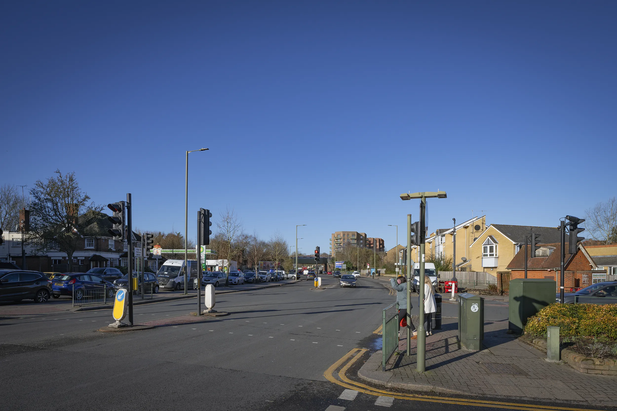
View 1, Great North Road beside the listed Odeon Cinema, rendered at AVR Level 3 from 245 metres.
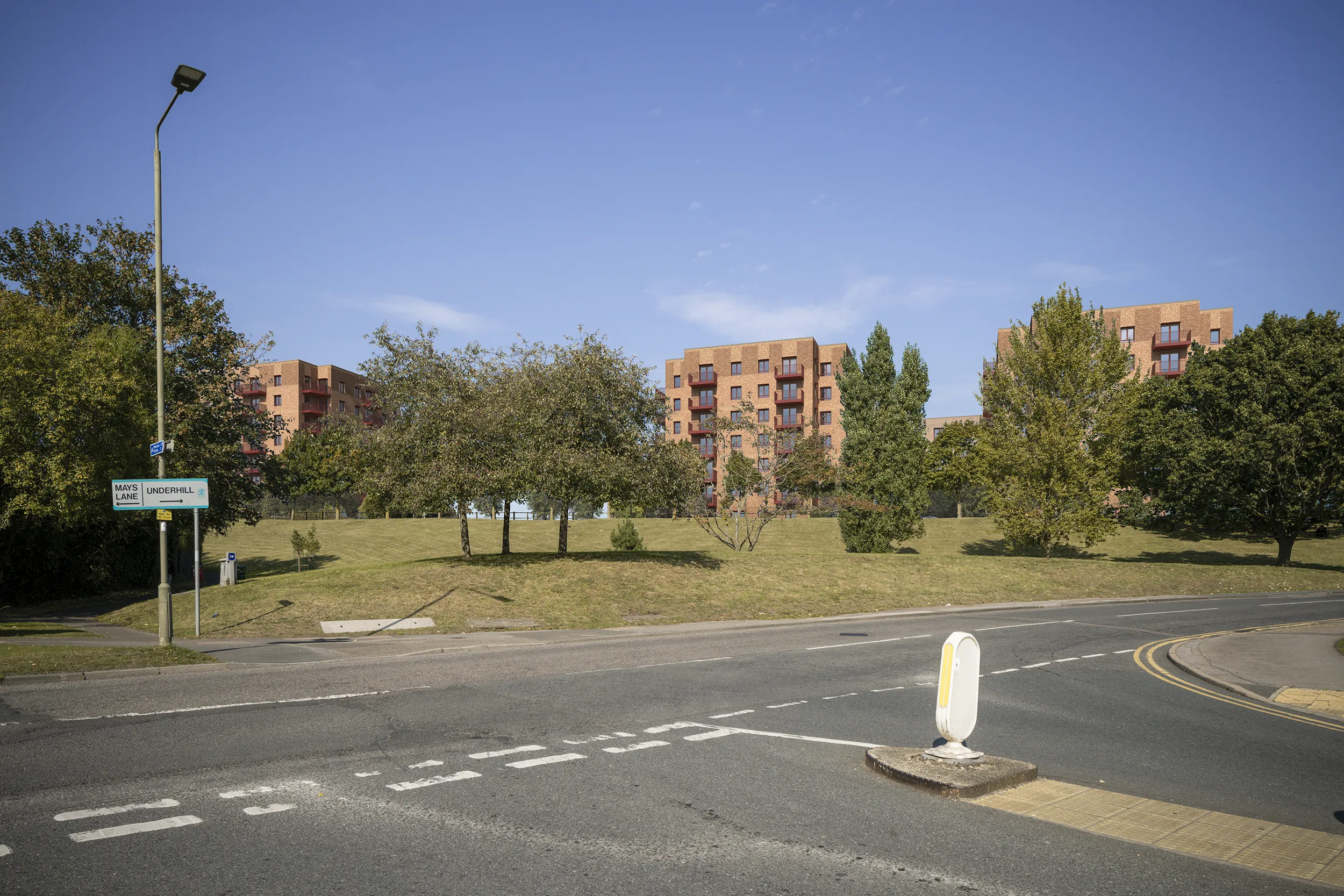
View 2, the Barnet Lane and Mays Hill junction, 103 metres from the site. Rendered at AVR Level 3, and the only view in the set with a High degree of change in both seasons alongside the London Loop.
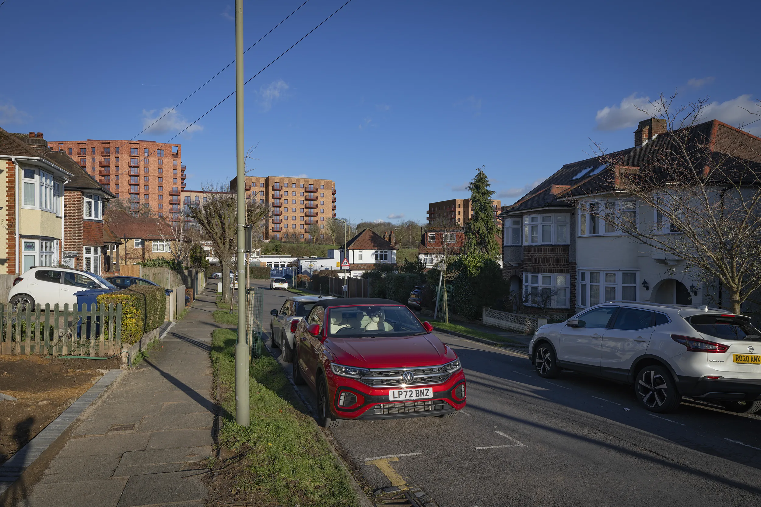
View 3, Elton Avenue, 170 metres north east. Produced as a wireline in summer and a render in winter, when the bare trees expose more of Buildings A and B above the rooflines.
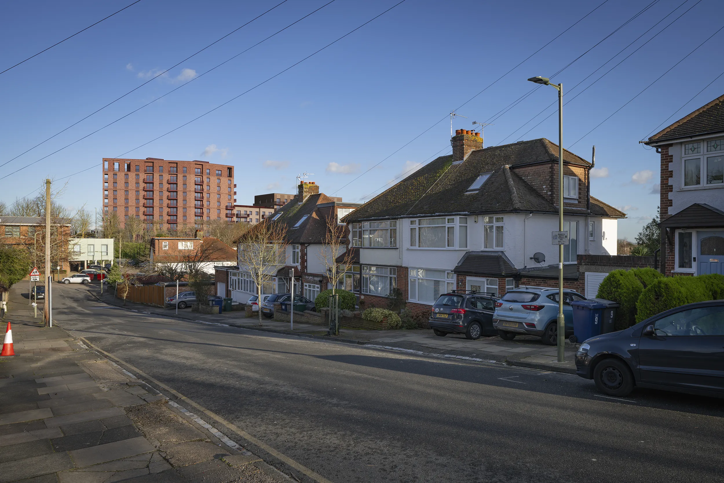
View 4, Woodfall Avenue, 170 metres west. Lichfields note the skyline profile stepping down towards the lower houses along the southern edge of the road, with Building A's crown breaking the element down further.
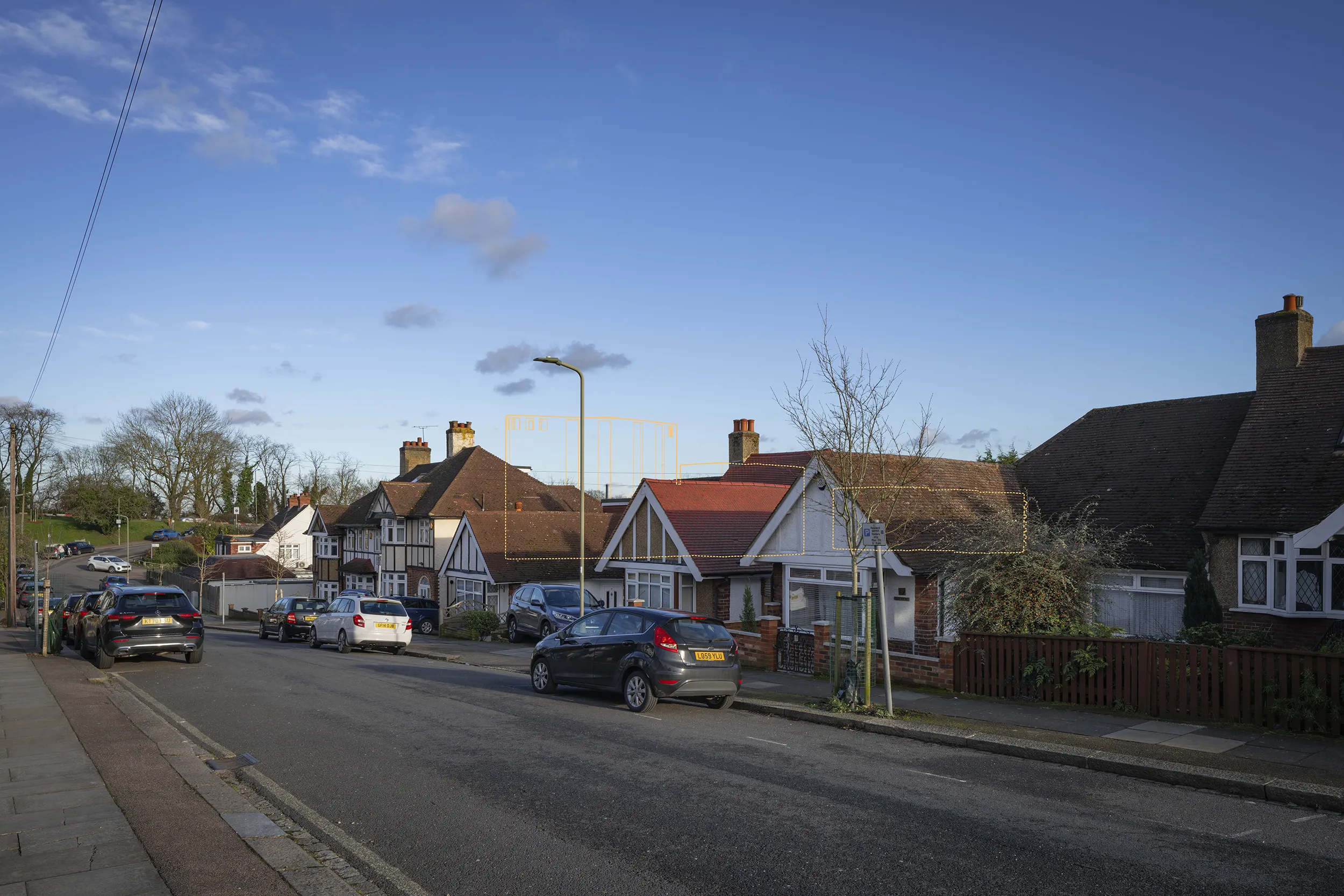
View 5, Milton Avenue, 181 metres. Winter only, and rendered rather than wireline: the TVA describes the buildings appearing in line with or lower than the existing skyline, with the brick tying in to the red and brown roof tiles in front.
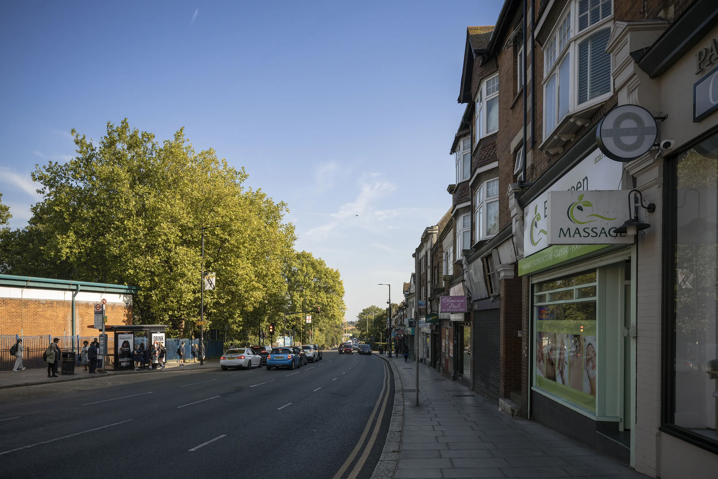
View 6, High Street at Normandy Avenue. At 81.6 metres this is the closest viewpoint in the set, and also the highest at 119.7 metres AOD, yet Buildings A and B are screened by the foreground trees in both seasons.
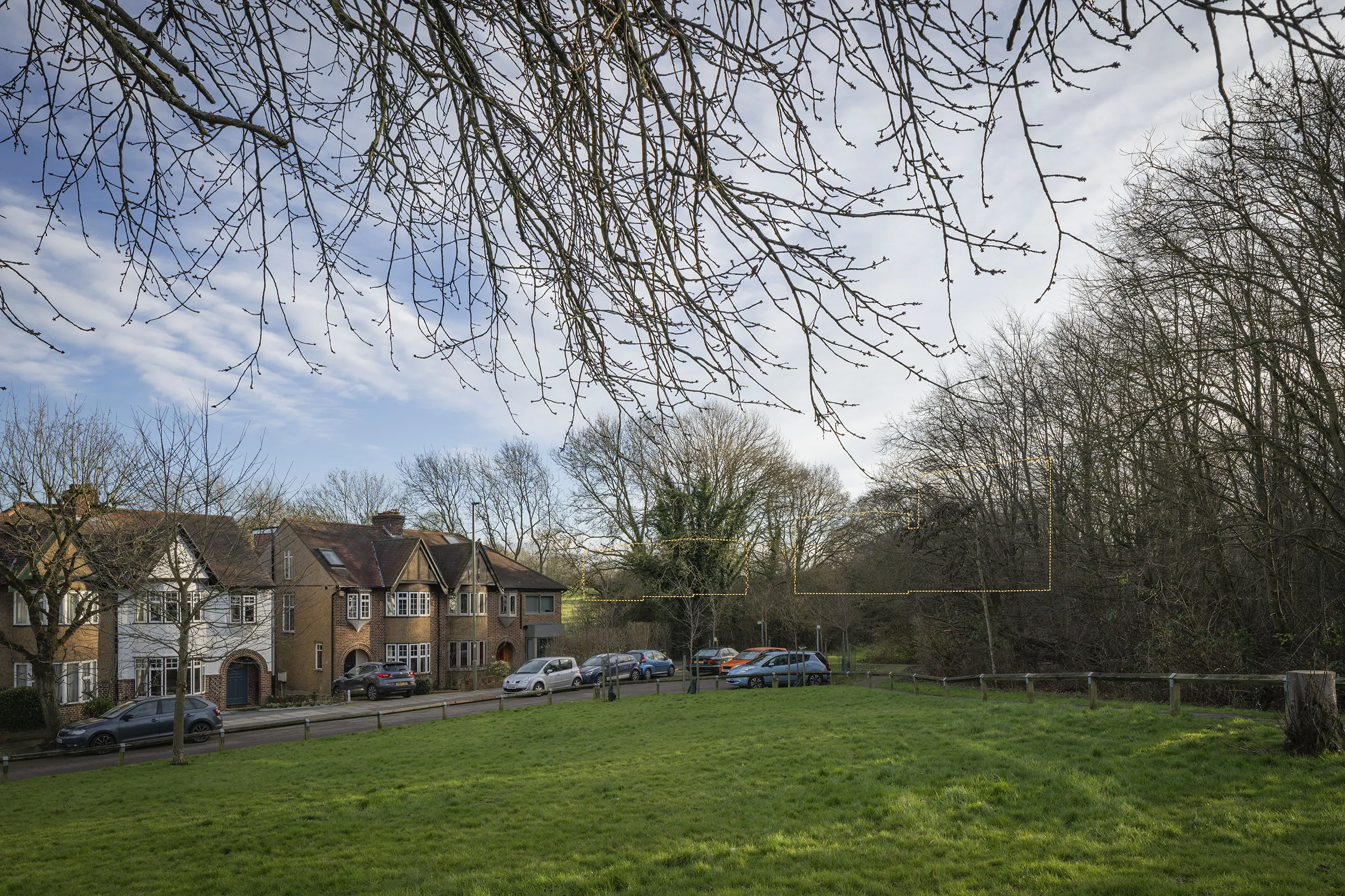
View 7, Meadway, 227 metres north. Lichfields record the buildings sitting well below the trees and not out of scale with the houses, with the enclosure of the open space maintained in summer.
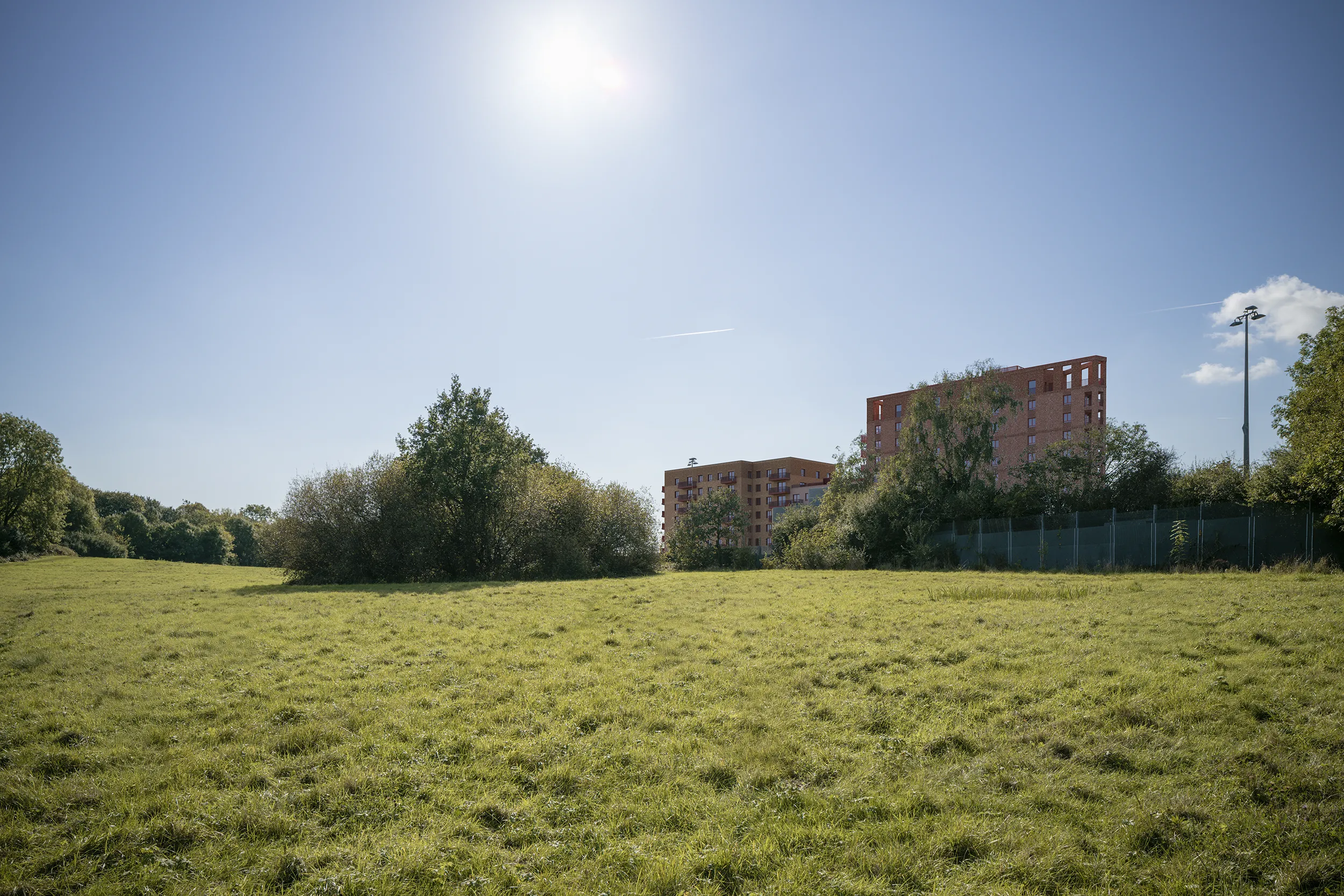
View 8, the London Loop, 171 metres from the site. A High degree of change in both seasons, the largest recorded anywhere in the appraisal, with the buildings forming a new backdrop to the open space.
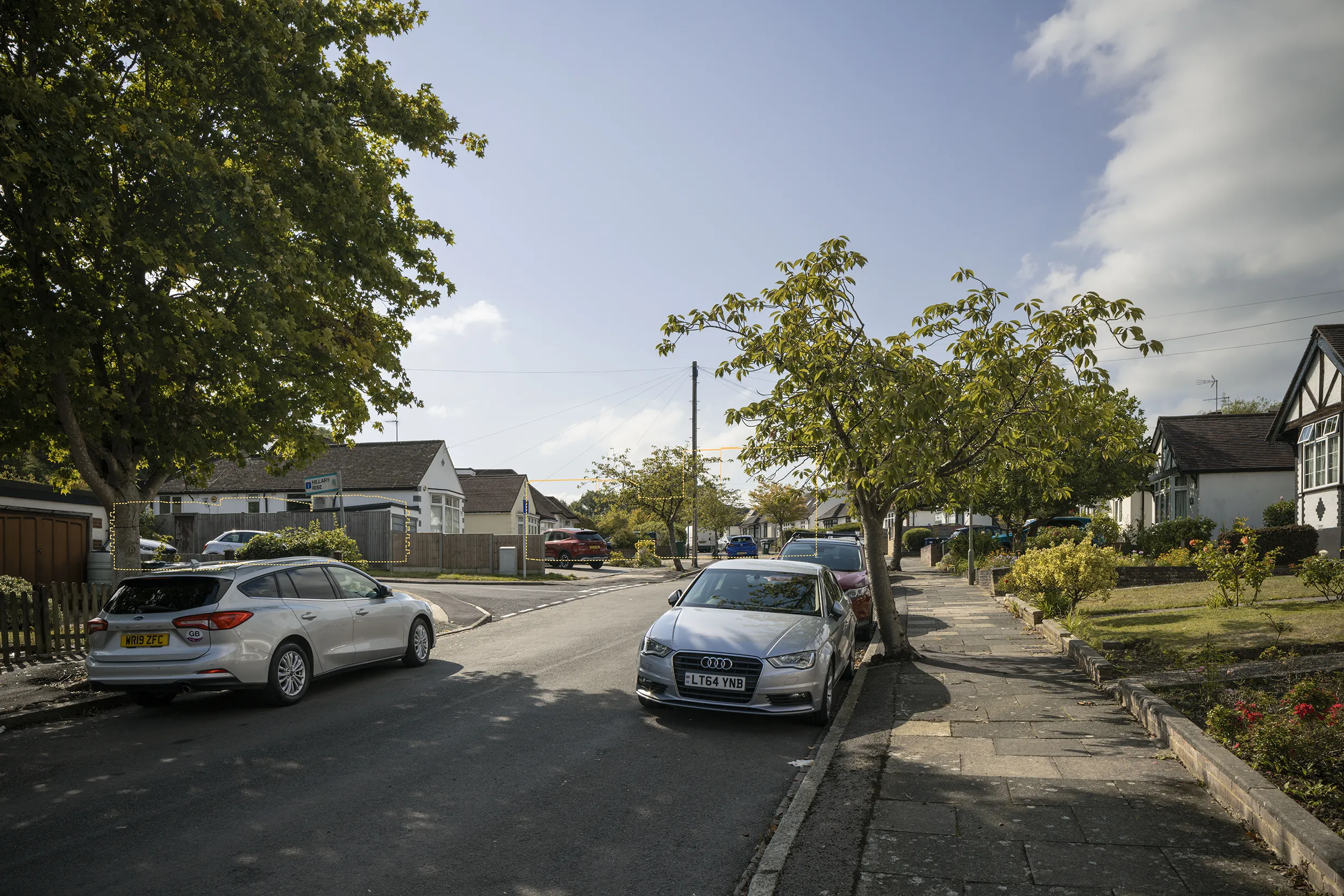
View 9, Kingsmead, 293 metres away. The TVA has Building B broadly aligning with the ridgelines of the bungalows on the southern side of the street.
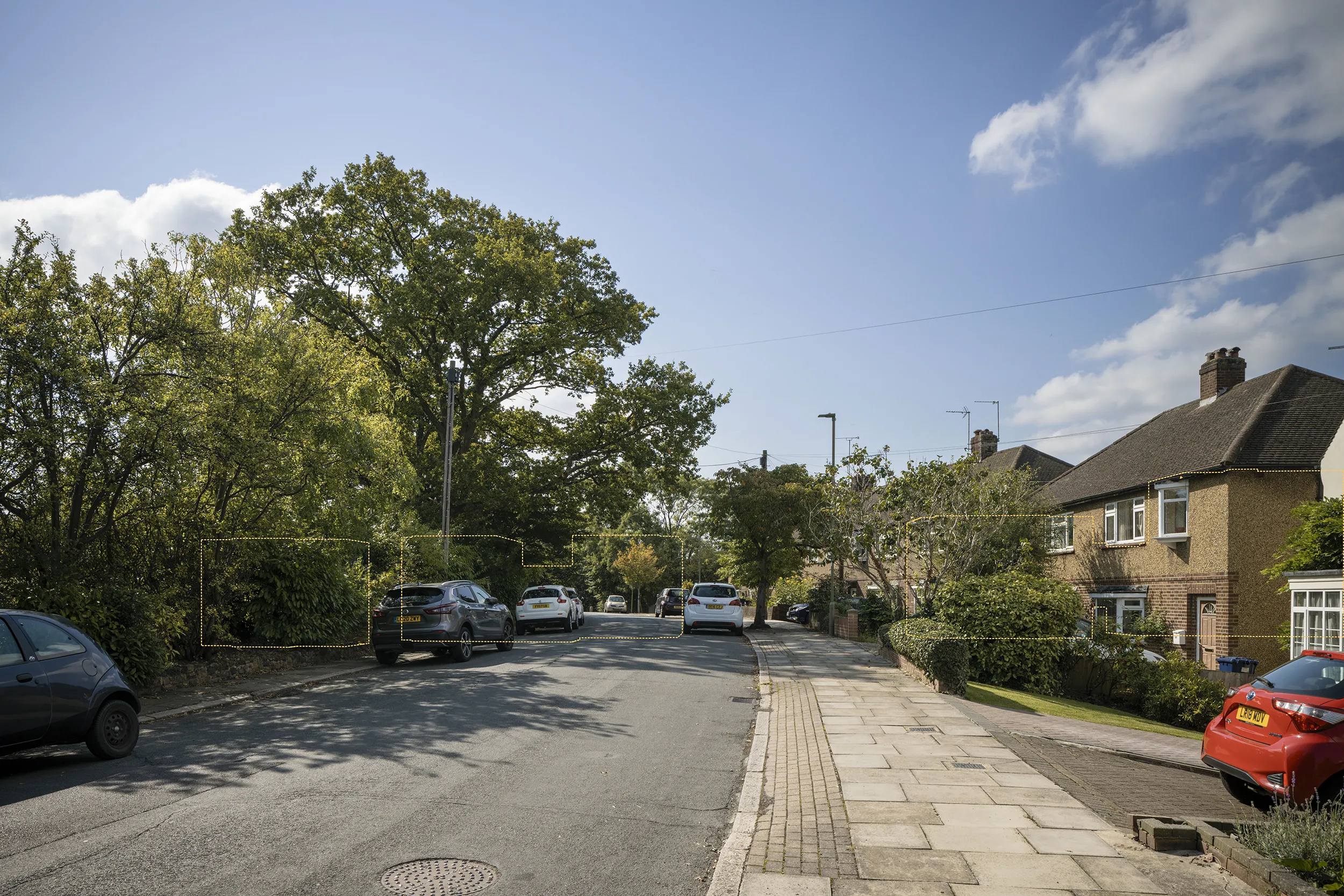
View 10, Potters Lane, 182 metres out and 105.7 metres AOD. Nil change in summer, Very Low in winter: Lichfields describe the buildings sitting well below the tree line and appearing lower than the houses along the street.
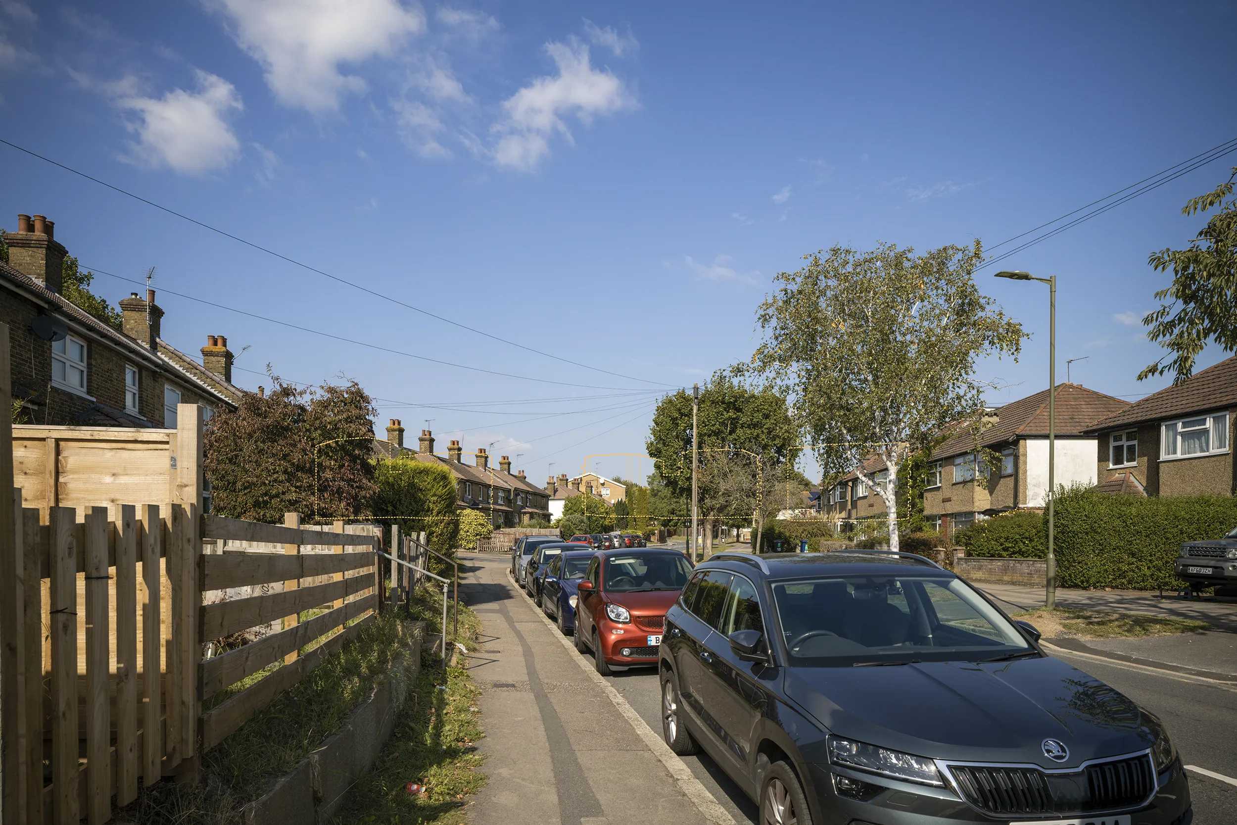
View 11, Barnet Lane at Ark Pioneer Academy, 301 metres south. The buildings form a new terminating feature to the street, stepping up from the two and three storey frontages in a comfortable transition of scale.
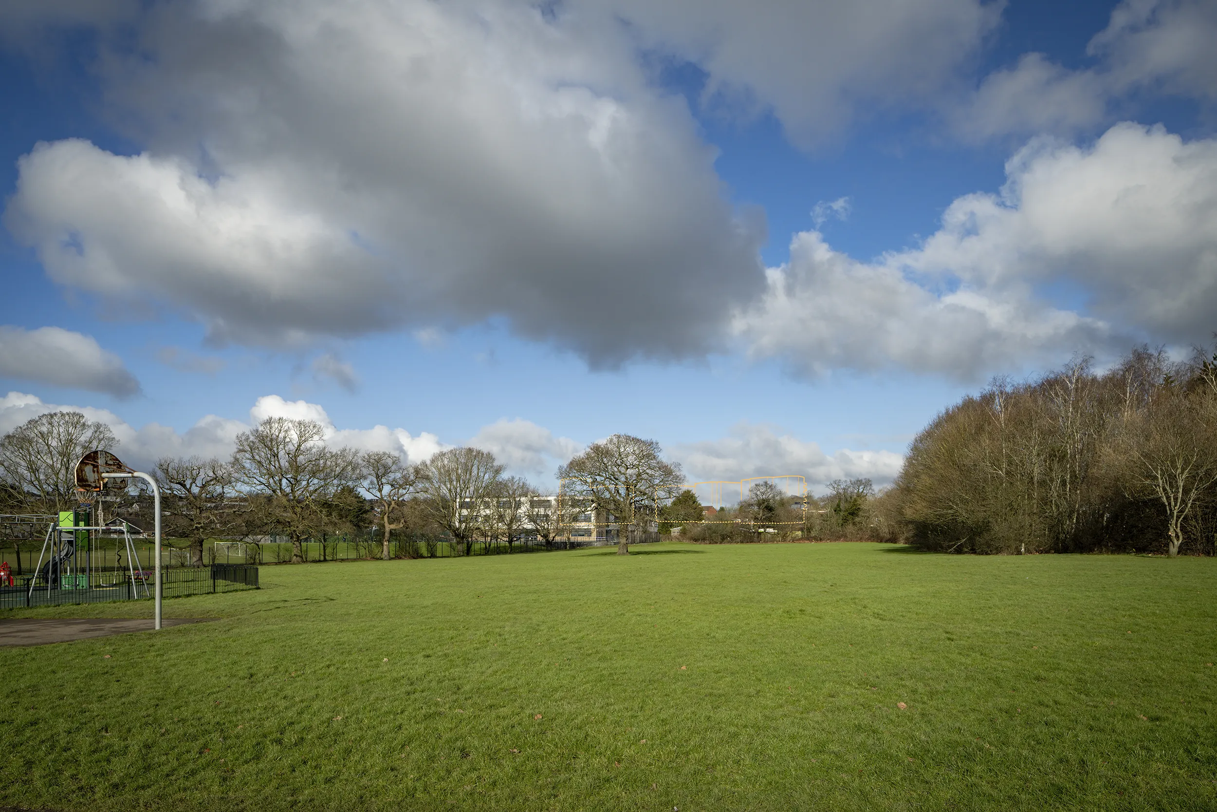
View 12, High Barnet Park, 457 metres south of the site. Lichfields note that in summer only the upper levels of Buildings D and E show through a gap in the canopy, with filtered views of the others in winter.
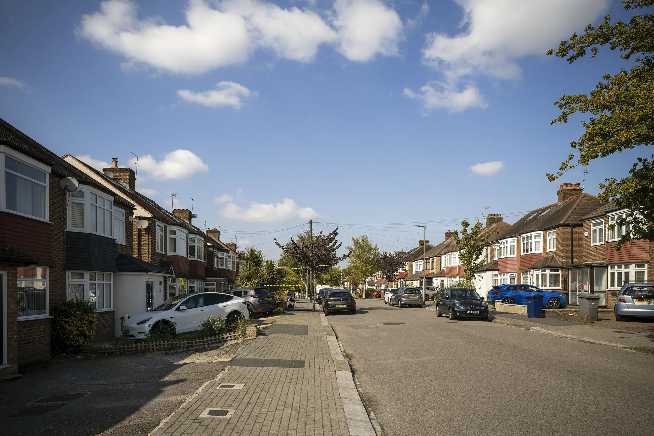
View 13, Sherrards Way, 525 metres out. In summer only sections of Buildings A and E are perceptible; the wireline records what the street trees leave visible.
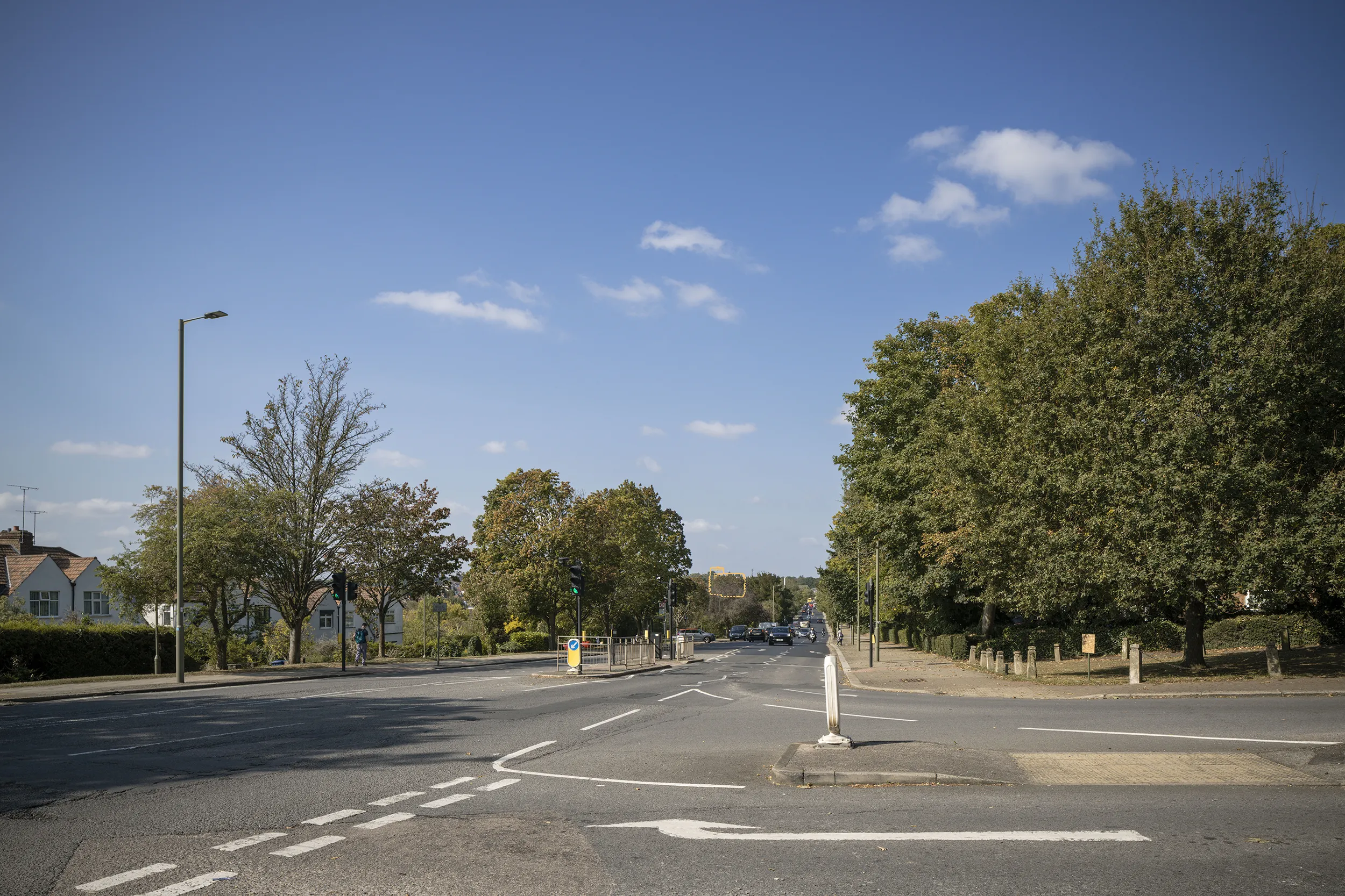
View 14, Pricklers Hill at Lyonsdown Road, 980 metres away. The longest of the rendered views, and the one that tests Building A's crown as a small distant marker for the station.

View 15, Gloucester Road, 618 metres. Winter only, because the TVA records the proposal as completely screened in summer. The buildings sit well below the firefighting drill tower behind.
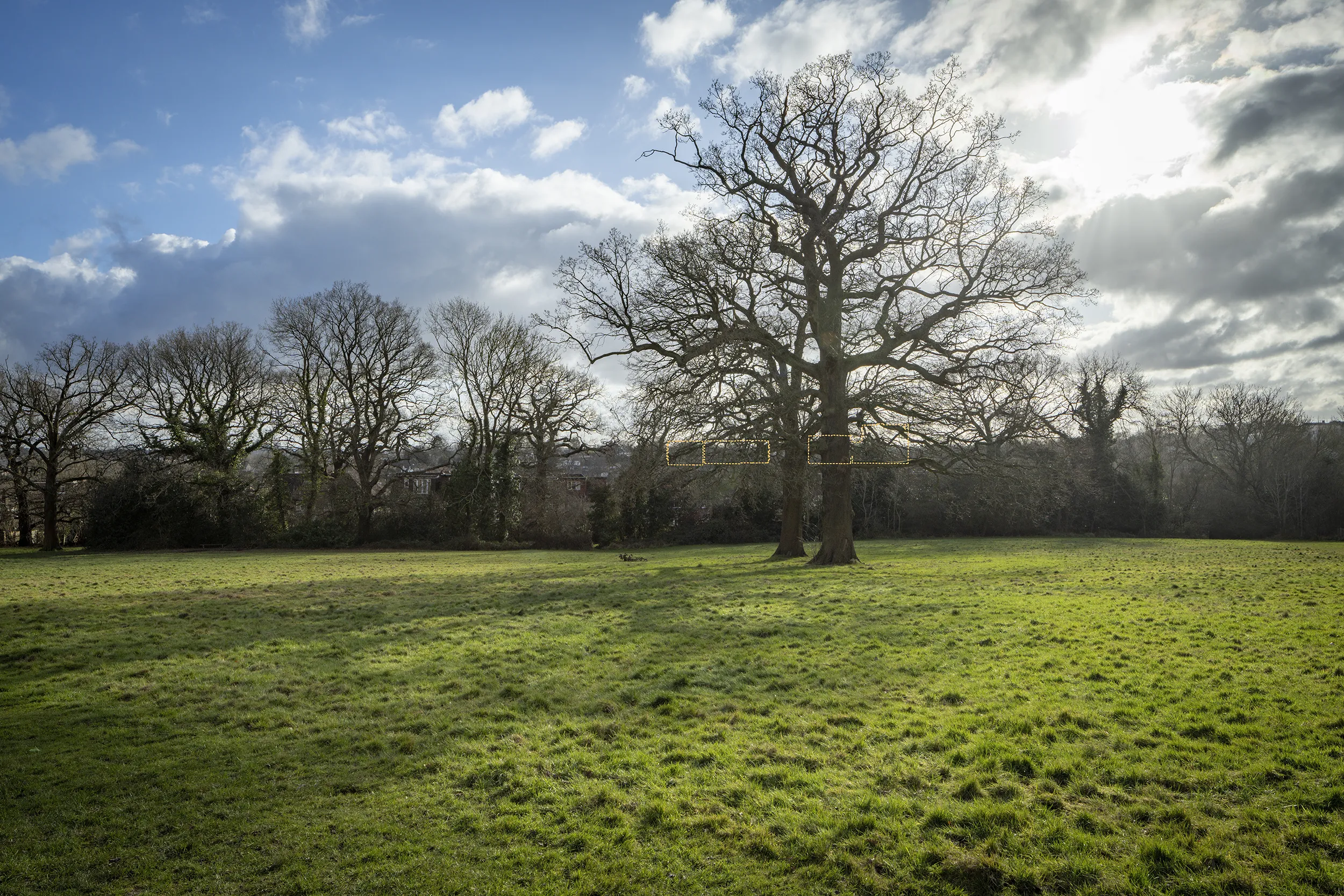
View 16, King George's Fields east of Shirebourne, 822 metres north of the site. Not visible at all in summer; the winter wireline shows only limited filtered glimpses on the skyline.
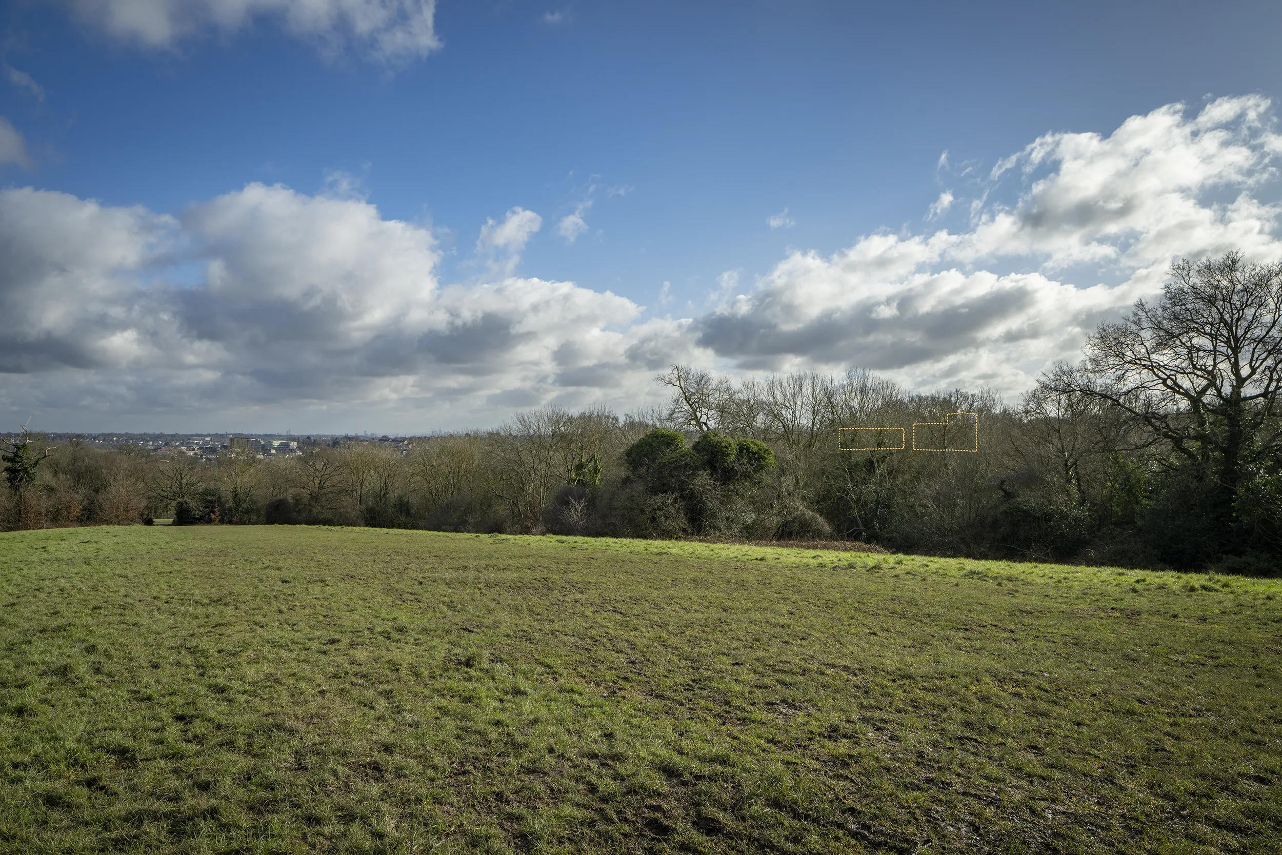
View 17, Locally Identified View 4. The site does not lie in the direction of the protected view cone, and Lichfields record a Nil degree of change and a Nil visual effect.
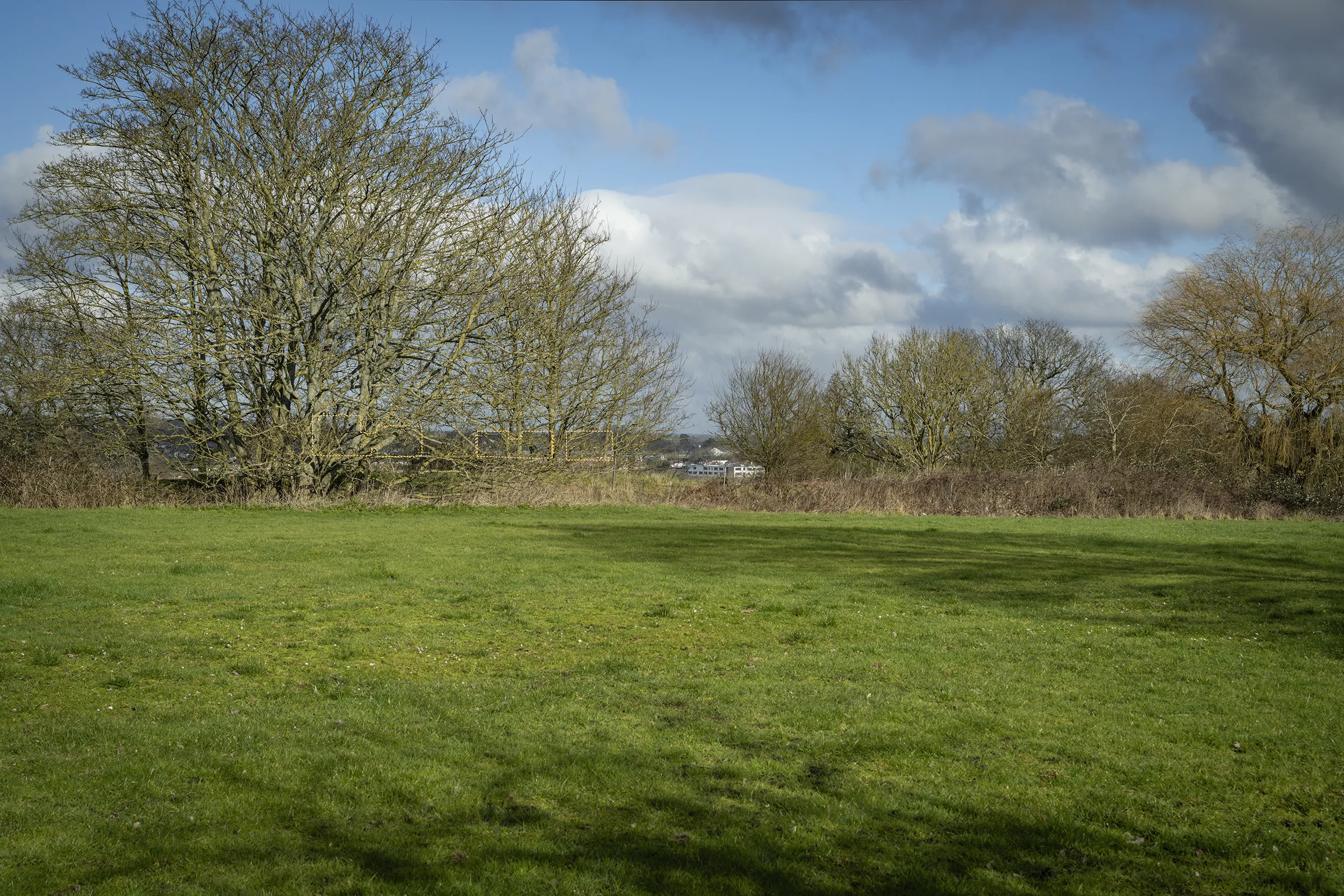
View 18, Badgers Croft in Totteridge, 1.75 kilometres away and the most distant in the set. Winter only, and even then the glimpses are described as difficult to differentiate from the wider context.w from Badgers Croft in Totteridge illustrating the minimal skyline profile across Dollis Valley.