Ley Street
Ilford IG1

Local Planning Authority
London Borough of Redbridge
Client
Q Developments Limited (IG1 Real Estate Limited)
Architects
Broadway Malyan
Consultants
Neaves Urbanism (Townscape and Visual), Boyer (Planning)
Visualisation Scope
13 AVR Level 1 (Wireline), 6 AVR Level 3 (Photorealistic Render)
Project Overview
Ley Street is a 0.65 hectare brownfield plot in Ilford, irregular in shape, tight against the railway corridor and until recently occupied by a four storey car park. The car park has gone and the site now sits cleared, within the Ilford Metropolitan Town Centre Investment and Growth Area, where Redbridge policy supports tall and large buildings.
Broadway Malyan's scheme puts three blocks around a central area of public realm. Block 1 is part five and part six storeys to the north east, holding self contained homes above ground floor commercial space and finished in a subtle red brick that steps the scheme down to Ley Street. Block 2 rises 26 storeys to the south west, clad in mid grey brick with fluted concrete detailing, and holds co-living accommodation. Block 3 is the tallest at 29 storeys to the south east, purpose built student accommodation in white brick with pale grey fluted precast.
Nineteen verified viewpoints were agreed with Redbridge officers to test the proposal. Eye-kon produced the Accurate Visual Representations for the Townscape and Visual Impact Appraisal prepared by Neaves Urbanism.
Planning and Heritage Context
Two towers of 29 and 26 storeys in a town centre need evidence rather than argument. The application had to demonstrate compliance with Policy D9 (Tall Buildings) of the London Plan and Policy LP27 of the Redbridge Local Plan 2015 to 2030, both of which turn on how a tall building reads at street level and across the wider townscape.
There are no designated heritage assets on or immediately next to the site, but the study area holds several. The nearest listed building is the Grade II Former Barclays Bank on High Road, 175 m to the south west. The Chapel of Ilford Hospital of St Mary and St Thomas of Canterbury, Grade II*, lies 600 m west. Valentines Park, a Grade II registered park and garden, is 620 m north, and City of London Cemetery, registered at Grade I, sits to the west with two of the assessed viewpoints inside it.
What made the viewpoint set unusual is where the scheme starts from. In fourteen of the nineteen assessed views the site is not currently visible at all. Only the five closest, along Ley Street, Thorold Road, Wellesley Road and Myrtle Road, register it even as a glimpse. The task was to establish where two towers would appear in a townscape that presently shows nothing of the site, and how they would read when they did.
Eye-kon's Involvement
Eye-kon produced nineteen verified views for the application, thirteen at AVR Level 1 and six at AVR Level 3, all to Landscape Institute Type 4. The viewpoints were agreed with LB Redbridge officers and include immediate, mid range and long distance positions, six of which correspond to strategic viewpoints identified in Redbridge's own Tall Buildings Evidence Base.
The Level 3 renders sit where the buildings are read close to: Wellesley Road, Thorold Road, both ends of Ley Street, Myrtle Road and the High Road at Clements Road. Everything beyond that distance is a wireline, because at 1 to 2.6 kilometres the question is where the profile falls on the skyline rather than what the brick looks like.
Production Process
1 | Photography and survey
Baseline photography was taken at all nineteen viewpoints in a single campaign on 3 April 2025, with South Park added on 8 April. A full frame camera was used on a levelled tripod, set at 1.6 metres above a survey nail placed at each camera position.
Two lenses were used, split by distance. A 24 mm tilt shift with a 74 degree horizontal field of view covers the thirteen viewpoints out to 870 metres. A 50 mm at 40 degrees covers the six long range positions, from Aldborough Road South at just over a kilometre to Wanstead Flats at 2.6 kilometres.
Camera locations and ground control points were surveyed to the Ordnance Survey OSGB36 datum, with between 12 and 15 control points recorded per viewpoint across foreground, middle distance and background.
2 | 3D modelling and camera matching
The proposed development was modelled in Autodesk 3ds Max from Broadway Malyan's plans, elevations and sections. Surveyed camera coordinates, Easting, Northing and AOD level, were used to recreate each viewpoint, and the virtual cameras were matched to the lens used on site. Camera matching and parallax checks confirmed the alignment of the buildings against the surveyed baseline.
3 | Material and lighting calibration
Lighting was reconstructed with the V-Ray Sun and Sky system, calibrated to the site's location and to the date and time of each baseline photograph. Materials were developed from the specification: white brick and pale grey fluted precast on Block 3, mid grey brick and fluted concrete on Block 2, red brick on Block 1, with gold and brass toned aluminium window frames and fluted GRC panels.
4 | Verified view production
Images were composited in Adobe Photoshop following Landscape Institute Technical Guidance Note 06/19, with AVR levels as defined in Appendix C of the London View Management Framework.
The thirteen Level 1 wirelines record the proposed profile and skyline in the mid and long range views. The six Level 3 renders carry materials and the relationship to the street along Ley Street and Adelaide Road. Four consented but unbuilt schemes in the surrounding area were added as red wireline overlays from published planning information: the Sainsbury's Opportunity Site at up to 38 storeys, 193-207 High Road at up to 30, 226-244 High Road, and Redbridge Enterprise and Ilford Retail Park.
Technical Summary
Parameter | Project Specifications |
Site Location | Former Car Park Site, 12 Ley Street, Ilford, IG1 4BT |
Proposal | Mixed-use development featuring 29-storey PBSA tower, 26-storey co-living tower, and 5-6 storey residential block |
Architect | Broadway Malyan |
Client | Q Developments Limited |
Consultants | Neaves Urbanism (Townscape and Visual), Boyer (Planning) |
Total Viewpoints Assessed | 19 verified view locations, from 129 m to 2.6 km from the site centre |
AVR Deliverable Levels | 13 x Level 1 (Wireline), 6 x Level 3 (Photorealistic Render) |
Key Heritage & Landscape Receptors | Chapel of Ilford Hospital of St Mary and St Thomas of Canterbury (Grade II*), City of London Cemetery (Grade I RPG), Valentines Park (Grade II RPG), Former Barclays Bank (Grade II) |
Policy Context | London Plan Policy D9, Redbridge Local Plan Policy LP27 |
Technical Guidance | LI TGN 06/19, GLVIA3, LVMF Appendix C for AVR level definitions |
Nineteen Viewpoints, from Ley Street to Wanstead Flats
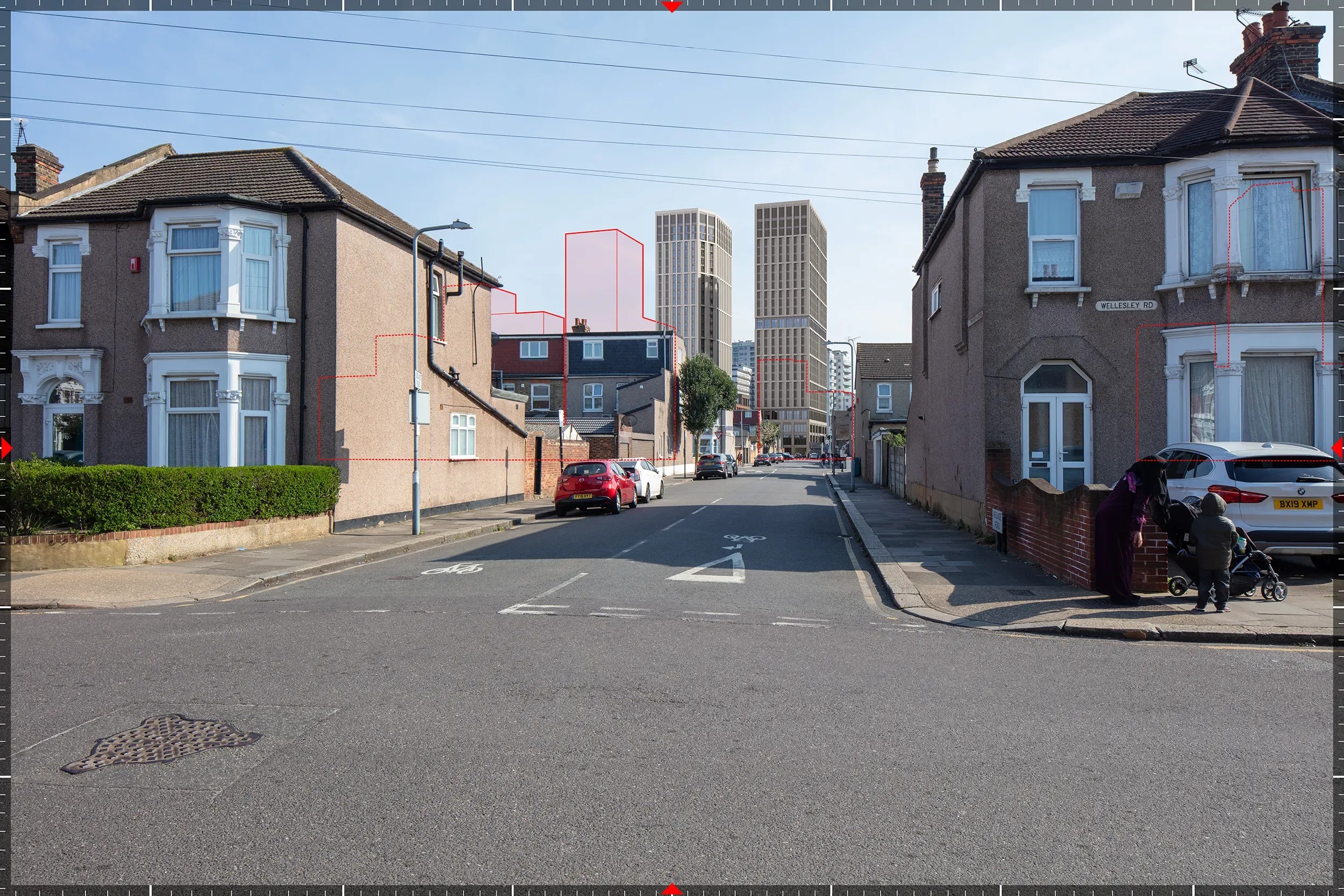
RV01, Wellesley Road, 315 metres from the site centre. One of only five viewpoints where the existing site is visible at all, and rendered at AVR Level 3 accordingly.
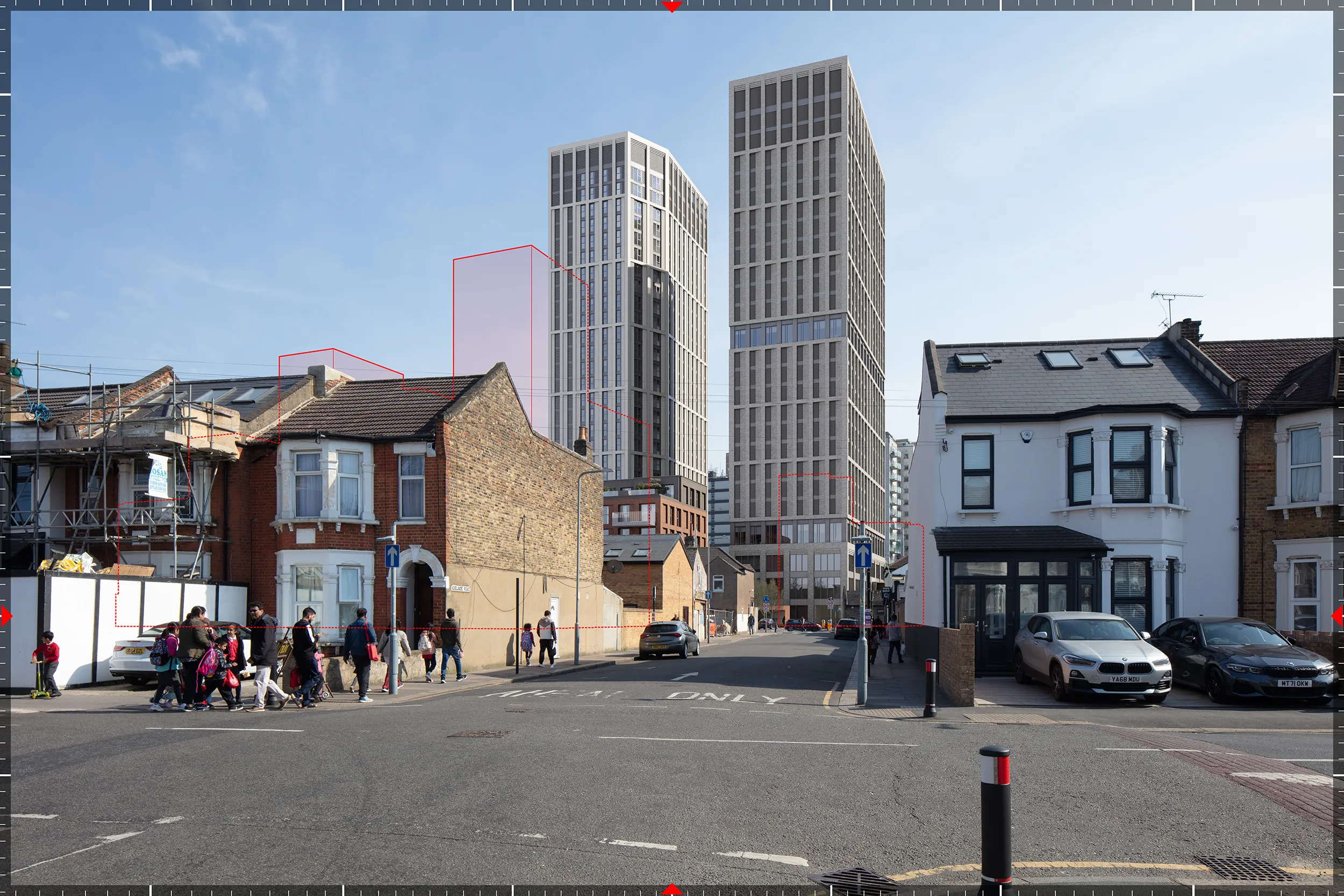
RV02, Thorold Road, 153 metres. Neaves record a partial existing view of the site here, and a major to moderate beneficial effect from the proposal.
RV03, Ley Street looking east into the site, rendered at AVR Level 3.
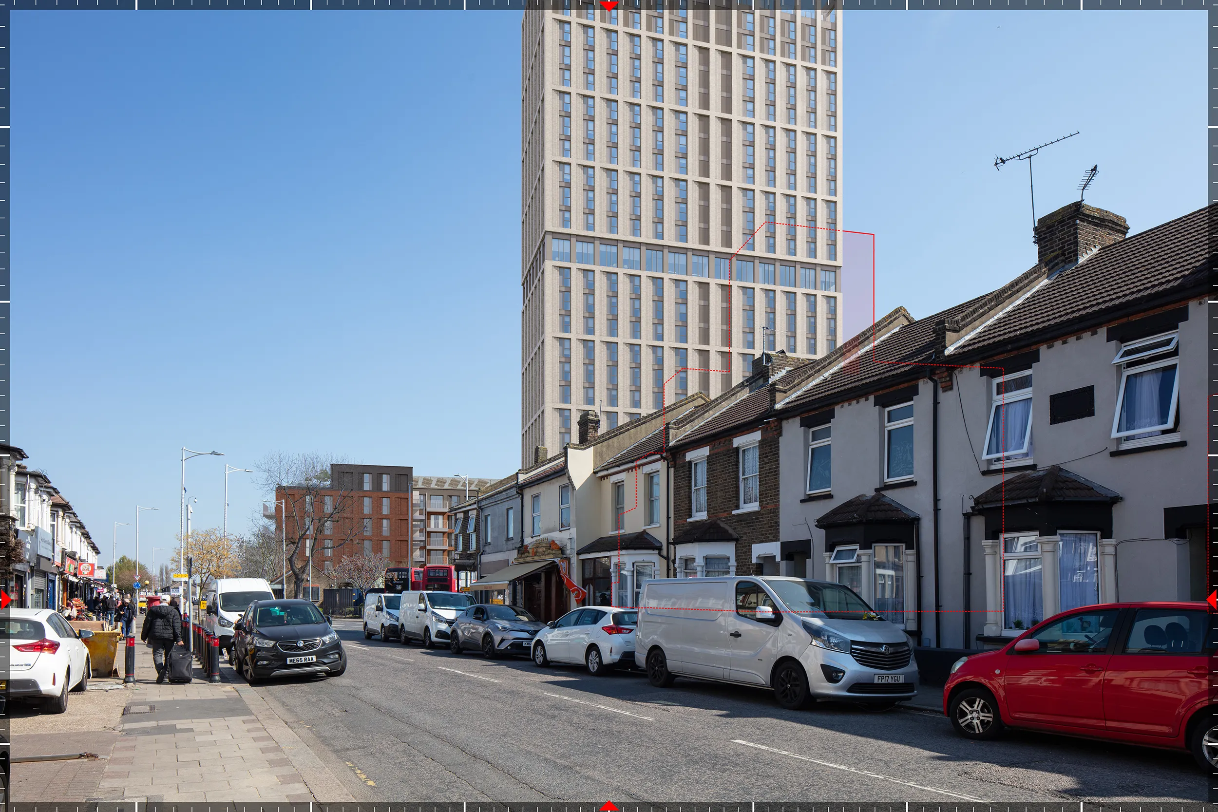
RV04, Ley Street looking west into the site, 137 metres. Rendered at Level 3, at the distance where the brick and the ground floor frontage do the work.

RV05, Myrtle Road, 280 metres. The existing site is a limited glimpse from here; the render tests what replaces it.
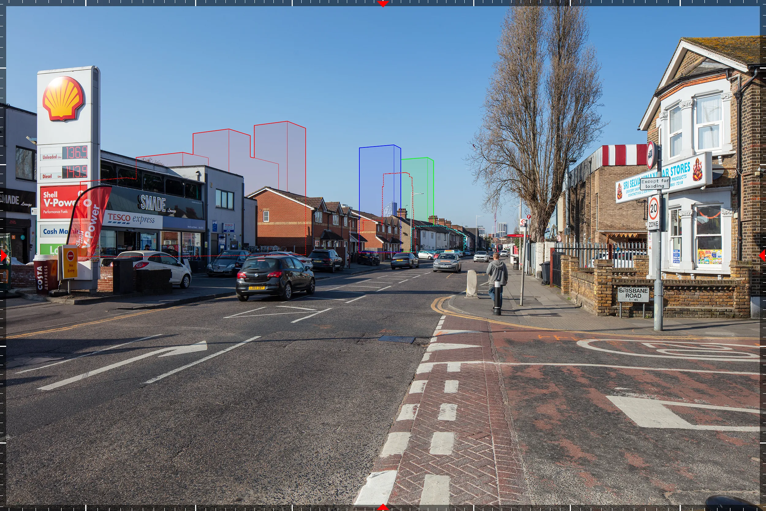
RV06, Ley Street at Brisbane Road, 449 metres. The first of the wirelines, and the first viewpoint from which the existing site cannot be seen at all.
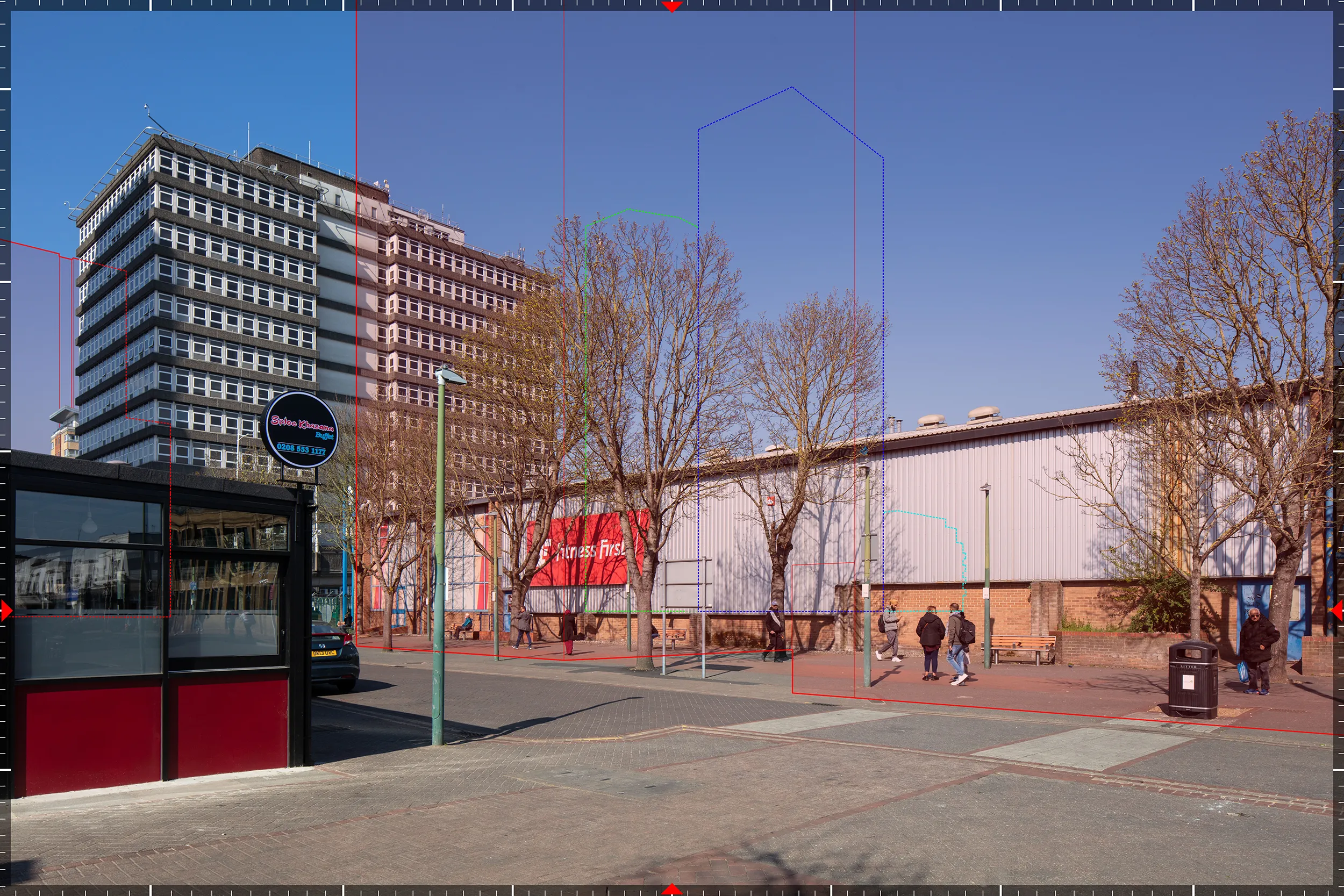
RV07, High Road, 203 metres. Close in, but with no existing view of the site: a wireline records exactly how much of the proposal appears.
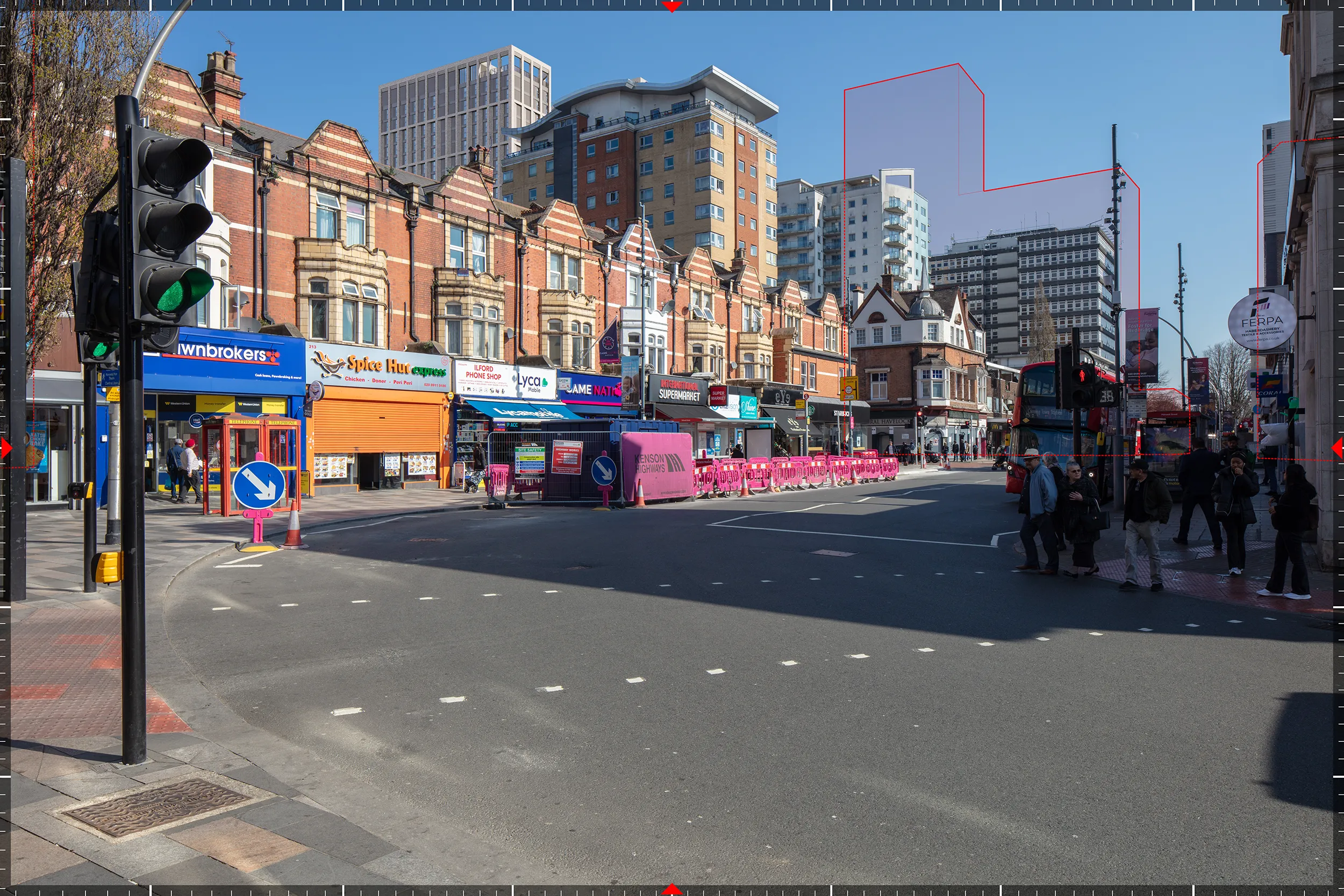
RV08, High Road at Clements Road, 242 metres. The only Level 3 render taken from a viewpoint with no existing view of the site.

RV09, Ilford Hill, 725 metres. One of six viewpoints drawn from Redbridge's own Tall Buildings strategic view list.
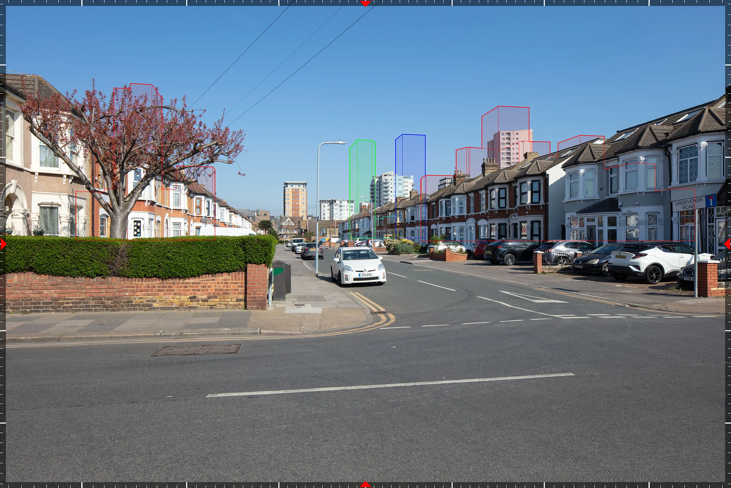
RV10, Grosvenor Road, 463 metres. Wireline at AVR Level 1.
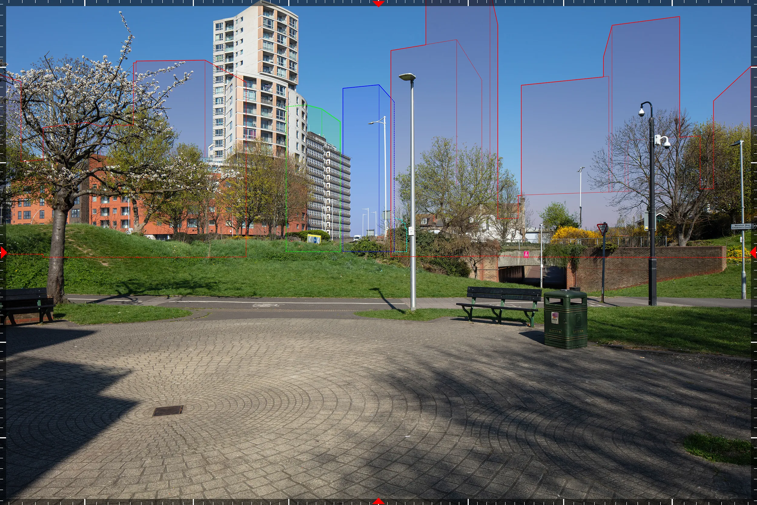
RV11, Philpot Path, 320 metres north west of the camera position.
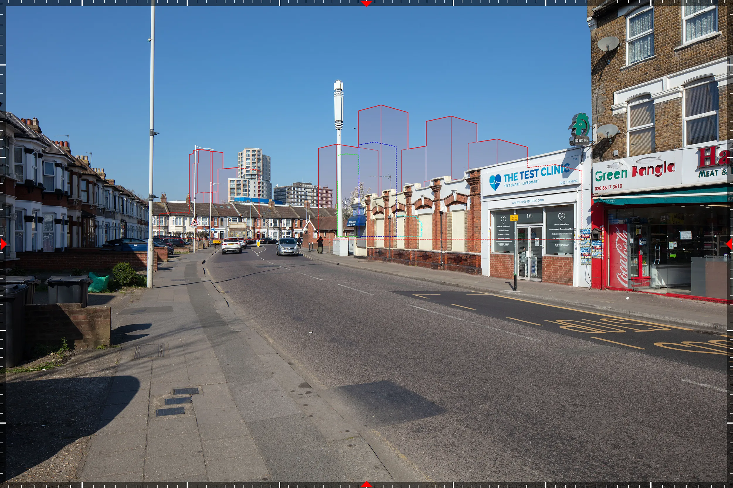
RV12, Green Lane, 512 metres. Wireline at Level 1.
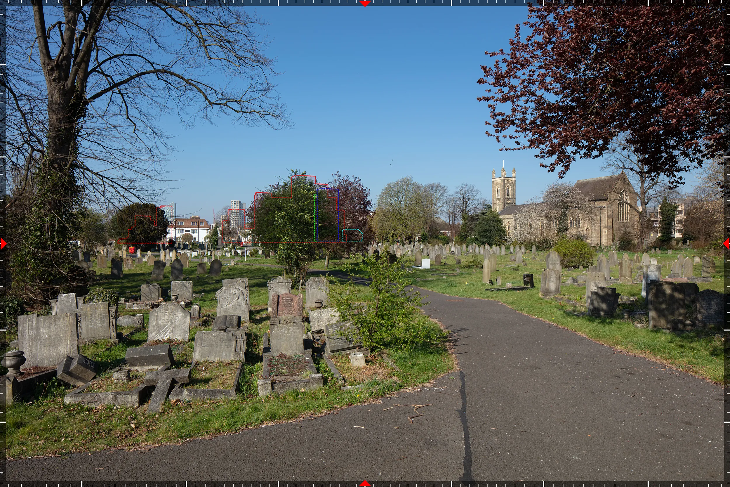
RV13, Buckingham Road Cemetery, 870 metres. The last of the 24 mm viewpoints, and the first of the long range open space views.
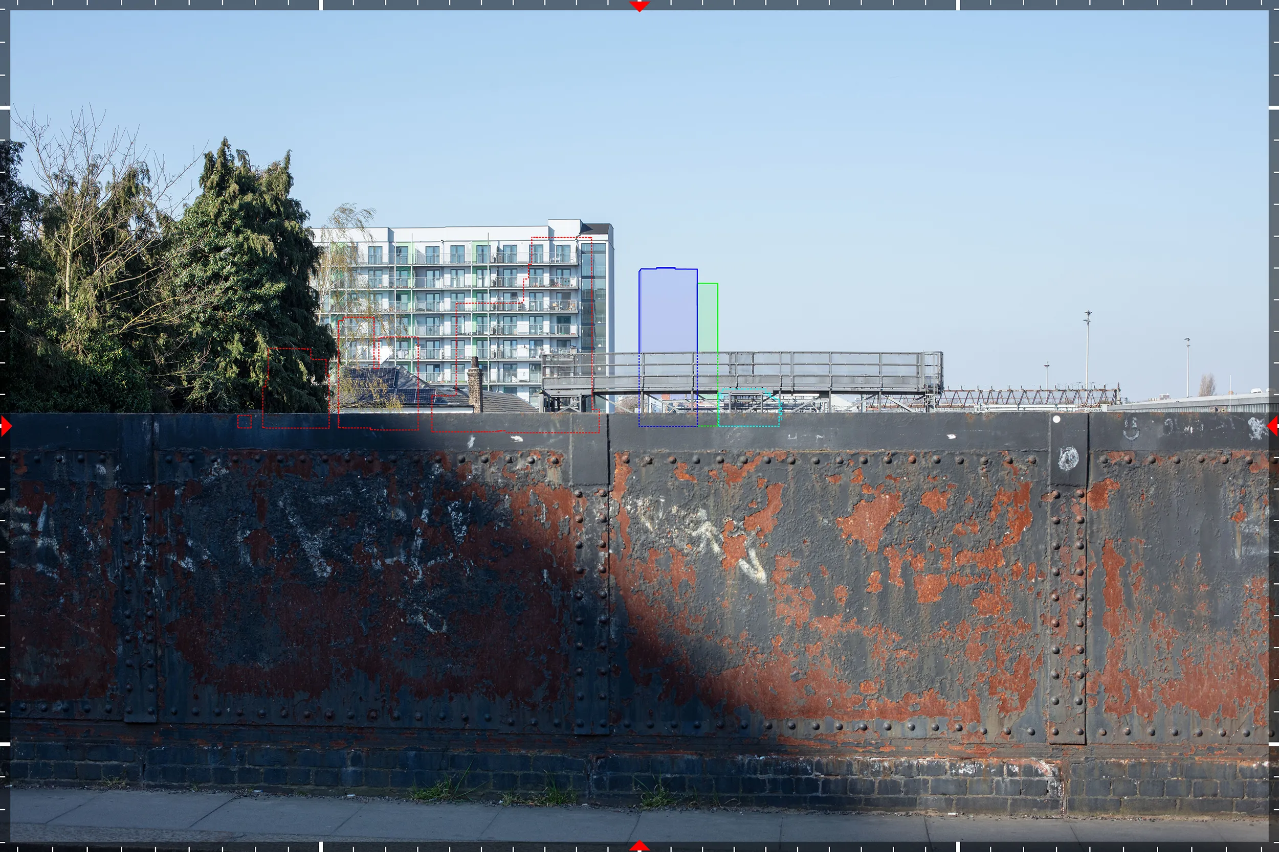
RV14, Aldborough Road South, 1.05 kilometres. Shot at 50 mm, the first of the six long range views, and one that runs along the railway line.
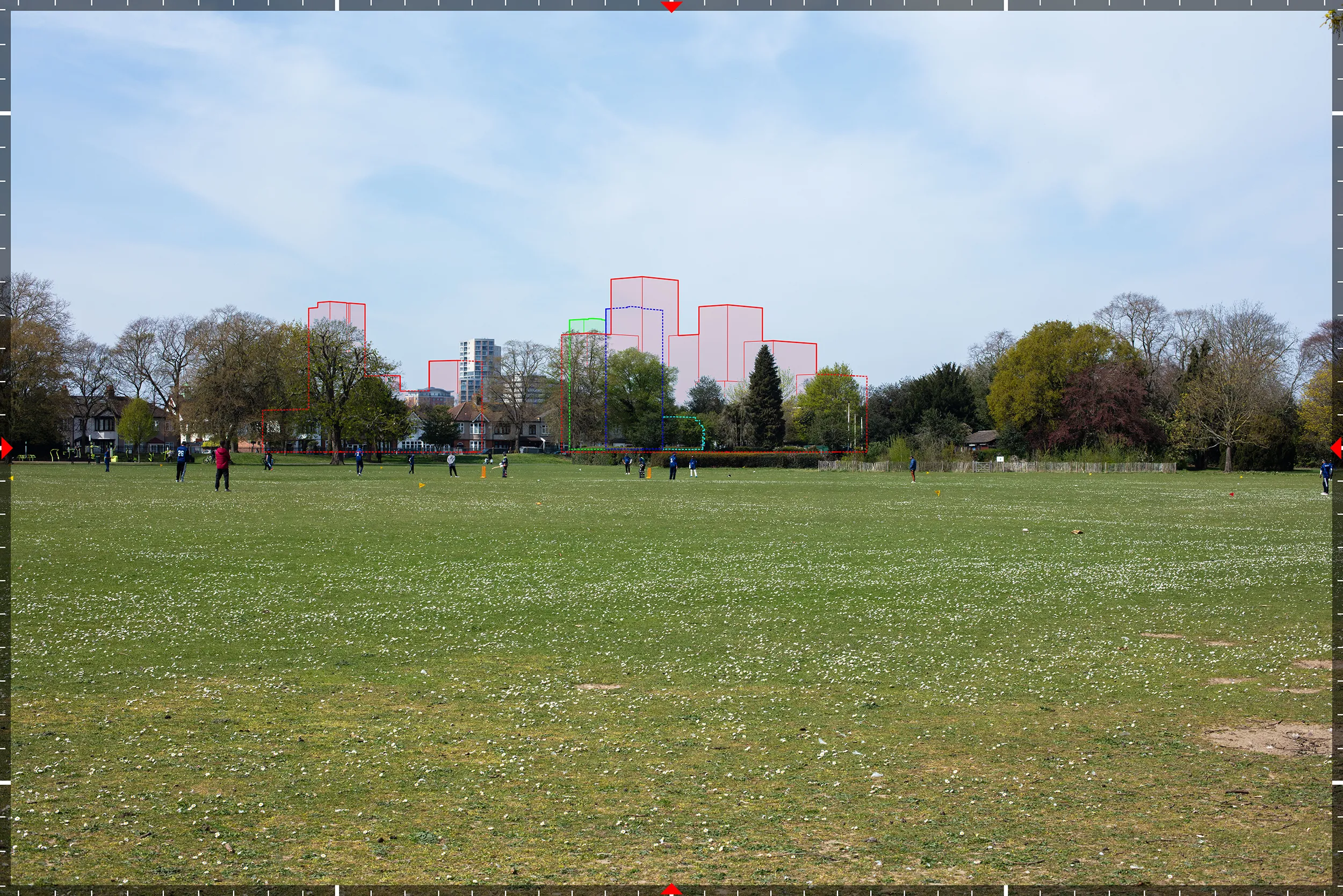
RV15, South Park, 1.26 kilometres. Neaves record the towers acting as a reference point for the eastern end of Ilford town centre in views of this length.
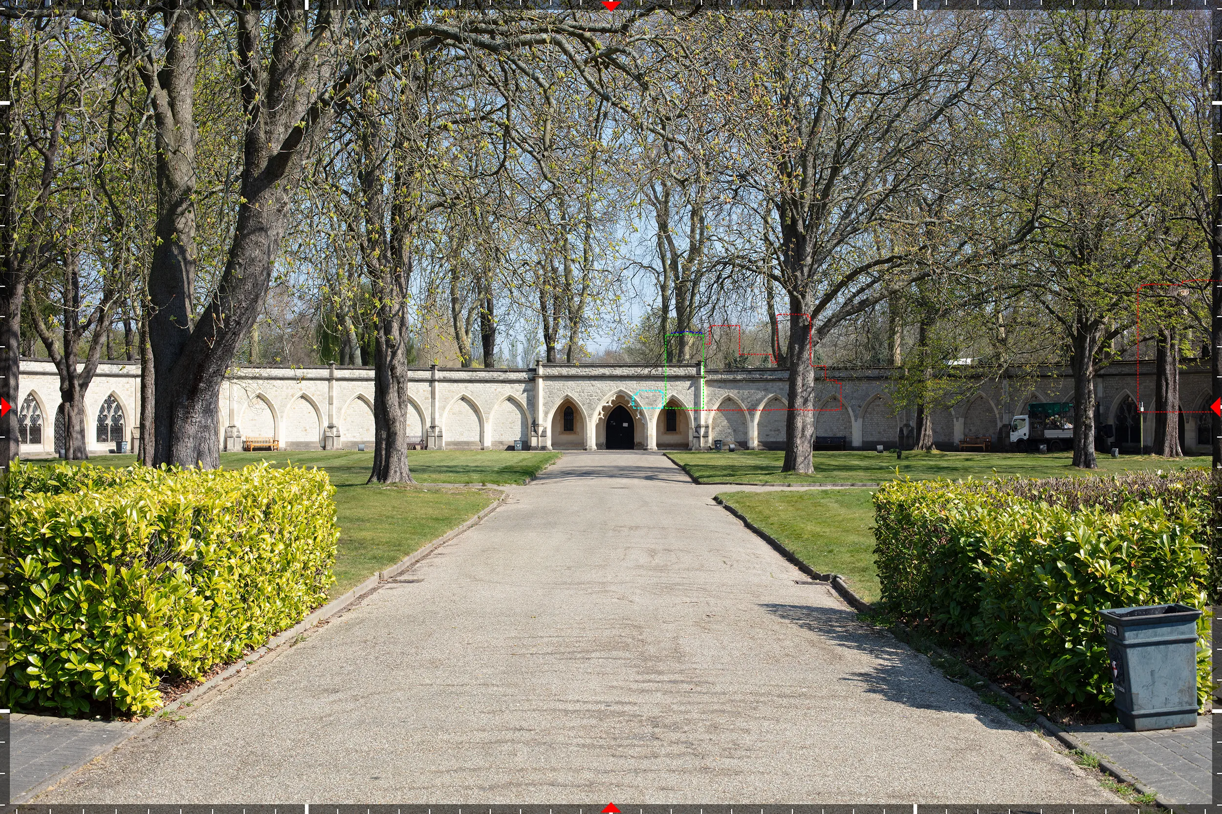
RV16, City of London Cemetery, 2.03 kilometres. The appraisal concluded no view of the proposal is gained from here.
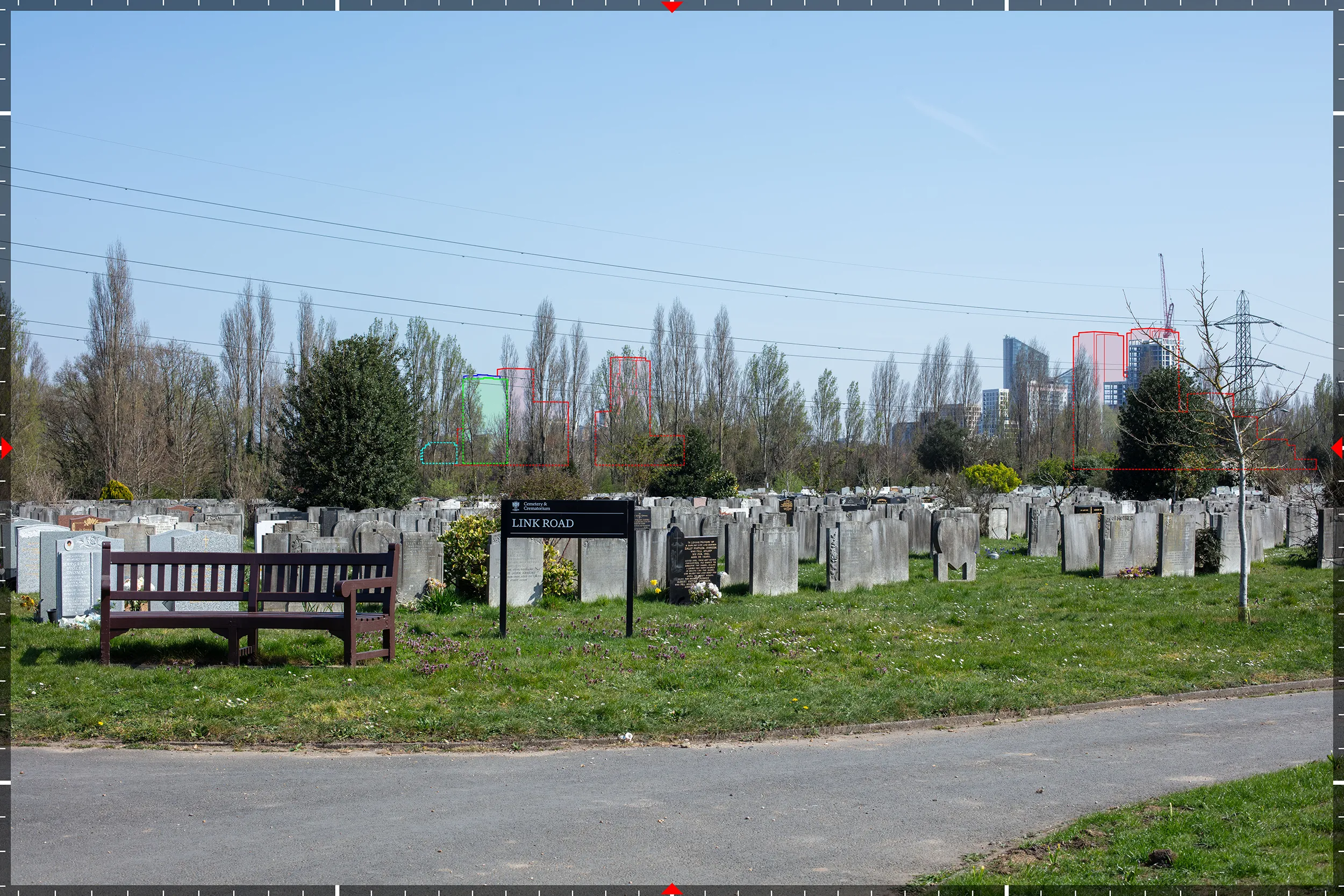
RV17, Lime Avenue, City of London Cemetery, 1.94 kilometres. The cemetery is a Grade I registered park and garden, which is why two viewpoints were taken within it.
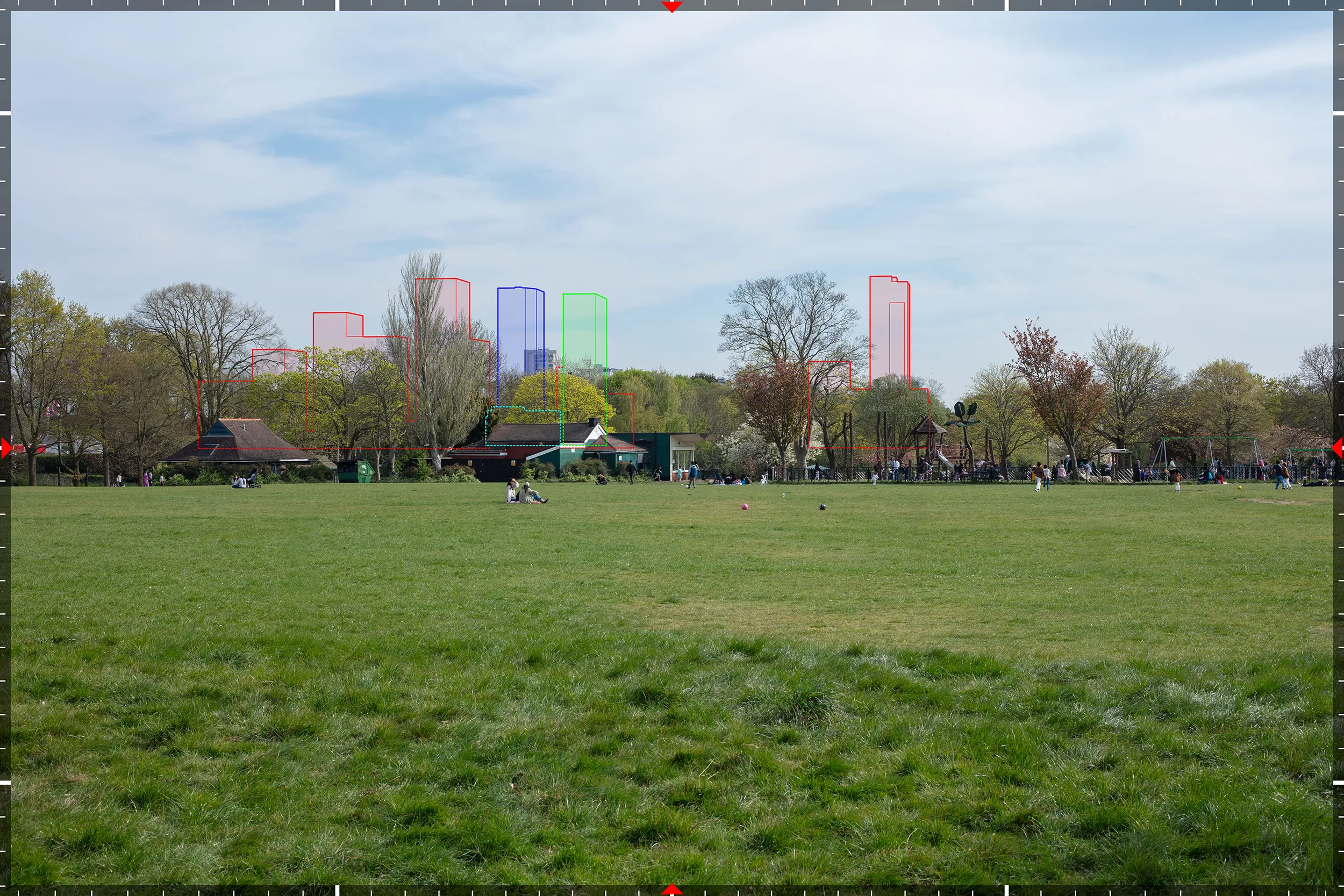
RV18, Valentines Park, 1.08 kilometres. A Grade II registered park and garden, and the long range view where the appraisal found the greatest benefit.
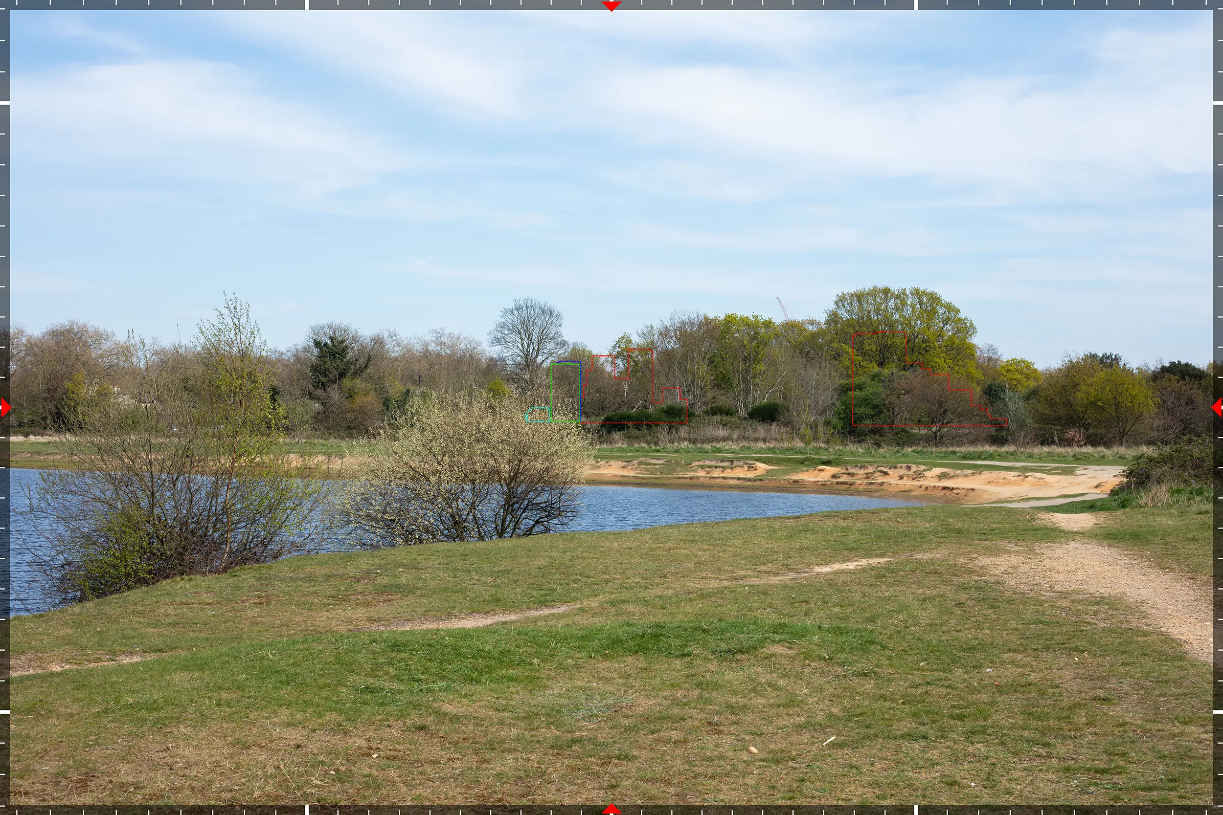
RV19, Wanstead Flats, 2.6 kilometres and the most distant viewpoint in the set. As at RV16, no view of the proposal is gained.