Royal London House
Wilmslow SK9
Local Planning Authority
Cheshire East Council
Client
The Royal London Mutual Insurance Society Ltd
Architects
JTP LLP (residential), Fatkin (multi-storey car park)
Consultants
Randall Thorp (Landscape and Visual), Ashton Hale (Planning), Heritage Architecture (Heritage)
Visualisation Scope
5 AVR Level 1 (Wireline), 2 AVR Level 3 (Photorealistic Render)
Project Overview
Royal London House sits on Alderley Road in Wilmslow, on part of what was once the Fulshaw Hall estate. The existing building is a vacant 1980s office with a decked car park alongside it, and the proposal replaces both.
Application 26/0102/FUL for The Royal London Mutual Insurance Society proposes 286 build to rent apartments in two six storey courtyard buildings, with a 364 space multi-storey car park to the south. The residential buildings were designed by JTP and the car park by Fatkin. Resident amenities in the western courtyard include a gym, a co-working lounge and a public café, and the landscape sits around and between the two courtyards.
The residential buildings reach +92.825 metres above Ordnance Datum at their highest point, and the car park +87.075 metres, both excluding lift overruns. The site is allocated for development under Site LPS 54 of the Cheshire East Local Plan Strategy 2010 to 2030.
Eye-kon produced seven verified views for the application, supporting the Landscape and Visual Impact Assessment and the Heritage Impact Assessment.
Planning and Heritage Context
The existing building has an unusual status. It was put forward for spot listing in 2018 and refused by Historic England, then granted a Certificate of Immunity from listing in May 2021, so it carries no statutory protection. Cheshire East nonetheless treat it as a non-designated heritage asset. Prior approval for its demolition was granted in October 2025, and the heritage assessment was still written on the basis that it stands, as a worst case.
What surrounds it matters more. A review of the townscape within a 250 metre study area identified two designated assets with the highest sensitivity to change: the Grade II listed Fulshaw Hall to the north, and its separately Grade II listed former Coach House. Both sit in mature parkland that once formed the wider estate. Harefield House, its northern and southern lodges and the southern lodge to Fulshaw Hall are locally listed, non-designated assets within the same study area.
Those assets, and the parkland setting they sit in, determined where the verified views were taken from. Topography and mature tree cover do most of the screening here, so many of the views are glimpsed or framed through vegetation rather than open.
Eye-kon's Involvement
Eye-kon produced seven verified views from publicly accessible locations around the site, five at AVR Level 1 and two at AVR Level 3, all to Landscape Institute Type 4.
The viewpoints were selected in consultation with the project heritage, planning and landscape consultants and with the Cheshire East heritage officer, then confirmed on site. Each verified view presents a matched pair, the existing condition and the proposed development, from the same surveyed camera position.
The two Level 3 renders were placed where materials matter most: VP03 on Alderley Road near the main access, and VP10 looking south from Fulshaw Hall into the site. Every other viewpoint is a wireline.
Production Process
1 | Photography and survey
Photography was carried out across two sessions, in April and August 2025, both timed for clear weather. Full frame cameras were used on levelled tripods at 1.6 or 1.65 metres above ground level, with a 24 mm lens on every viewpoint and a horizontal field of view of 74 degrees. Camera make, lens, focal length, tripod height, date, time and lighting conditions were recorded for each.
Five of the seven viewpoints were surveyed with a Leica TS15 total station and a Trimble Catalyst GNSS system, recording Ordnance Survey coordinates and AOD levels for the camera position along with around twenty control points per view, spread through foreground, midground and background and reaching up to about 750 metres from the camera. Where permanent ground markings were not possible and there were no hard reference features to work from, the survey was carried out alongside the photography using temporary poles.
For the two remaining viewpoints, camera positions were established from on site measurements plotted against Ordnance Survey mapping, with ground levels taken from the topographic survey at the nearest surveyed point.
2 | 3D modelling and camera matching
Both buildings were supplied as FBX models by their respective architects and positioned using corner coordinates provided by the design team. The scene origin was moved to a local reference point at Easting 384000, Northing 380000, to avoid the floating point drift that occurs when working at full national grid values.
For the surveyed viewpoints a script generated the aligned virtual camera, rendered the control points for visual checking and produced a text summary of the data used. The remaining two cameras were positioned manually from the recorded coordinates. In both cases the alignment was refined by block modelling the existing building footprints and other identifiable features from the topographic survey, which gives a second, independent check that the camera is where the survey says it is.
3 | Material and lighting calibration
For the two Level 3 viewpoints, lighting was rebuilt with the V-Ray Sun and Sky system, calibrated to the site's latitude and longitude and to the time and date of each photograph. Materials including brickwork, concrete, glazing and metal cladding were developed in V-Ray from the specification and sample swatches supplied by the design team. Contextual shadowing, reflection and occlusion were simulated using simplified models of the surroundings.
4 | Verified view production
Images were composited in Adobe Photoshop following Landscape Institute Technical Guidance Note 06/19 and Appendix C of the London View Management Framework, including the 2015 erratum.
The Level 1 wirelines are built from alpha channels and mattes, with the linework scaled, colour coded and offset to stay within the true profile of the massing. The Level 3 renders are composited into the original photograph with foreground elements masked from the site photography and survey references.
Every view carries graticules at 10 and 1 degree increments and a marked optical axis. Camera locations, heights and reference data have been retained and can be revalidated.
Technical Summary
Parameter | Project Specifications |
Site Location | Royal London House, Alderley Road, Wilmslow, SK9 1AT |
Proposal | 286 build to rent apartments in two six storey courtyard buildings, with a 364 space multi-storey car park, café and resident amenities. Application ref 26/0102/FUL |
Architect | JTP (residential), Fatkin (multi-storey car park) |
Client | The Royal London Mutual Insurance Society Limited |
Landscape and Visual | Randall Thorp |
Planning | Ashton Hale |
Heritage | Heritage Architecture |
Highest Point AOD | Residential +92.825 m, car park +87.075 m, both excluding lift overruns |
Total Viewpoints Assessed | 7, from 92 m to 308 m from the site centre |
AVR Deliverable Levels | Level 1 (Wireline), Level 3 (Photorealistic Render) |
Designated Heritage Assets | Fulshaw Hall (Grade II), former Coach House (Grade II) |
Non-designated Assets | Royal London House, Harefield House and its lodges, southern lodge to Fulshaw Hall |
Technical Guidance | LI TGN 06/19, LVMF Appendix C (2012 with 2015 erratum) |
The seven verified views
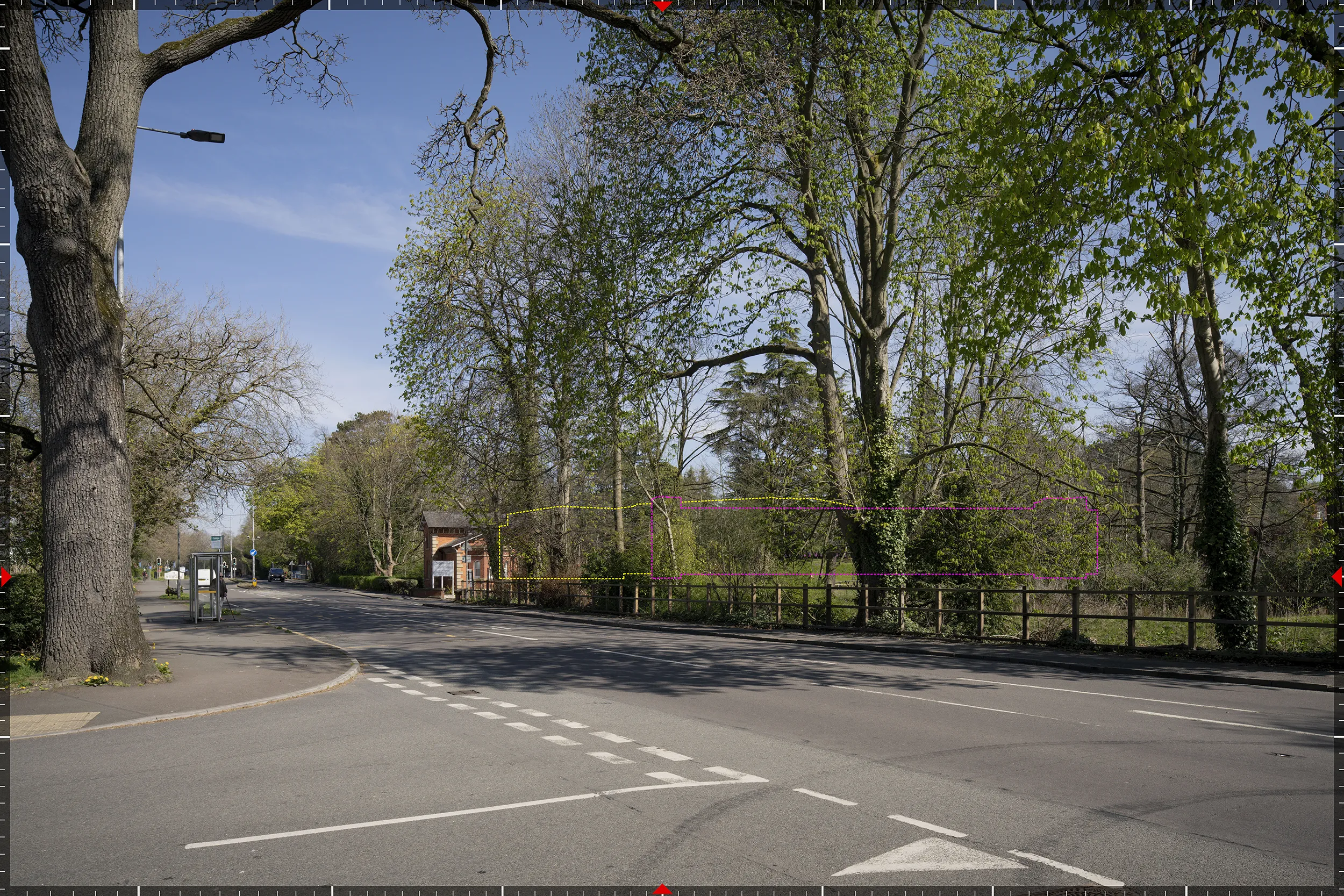
VP01, Alderley Road at Fulshaw Park South, 227 metres from the site centre and the most distant of the road views. Wireline at AVR Level 1.
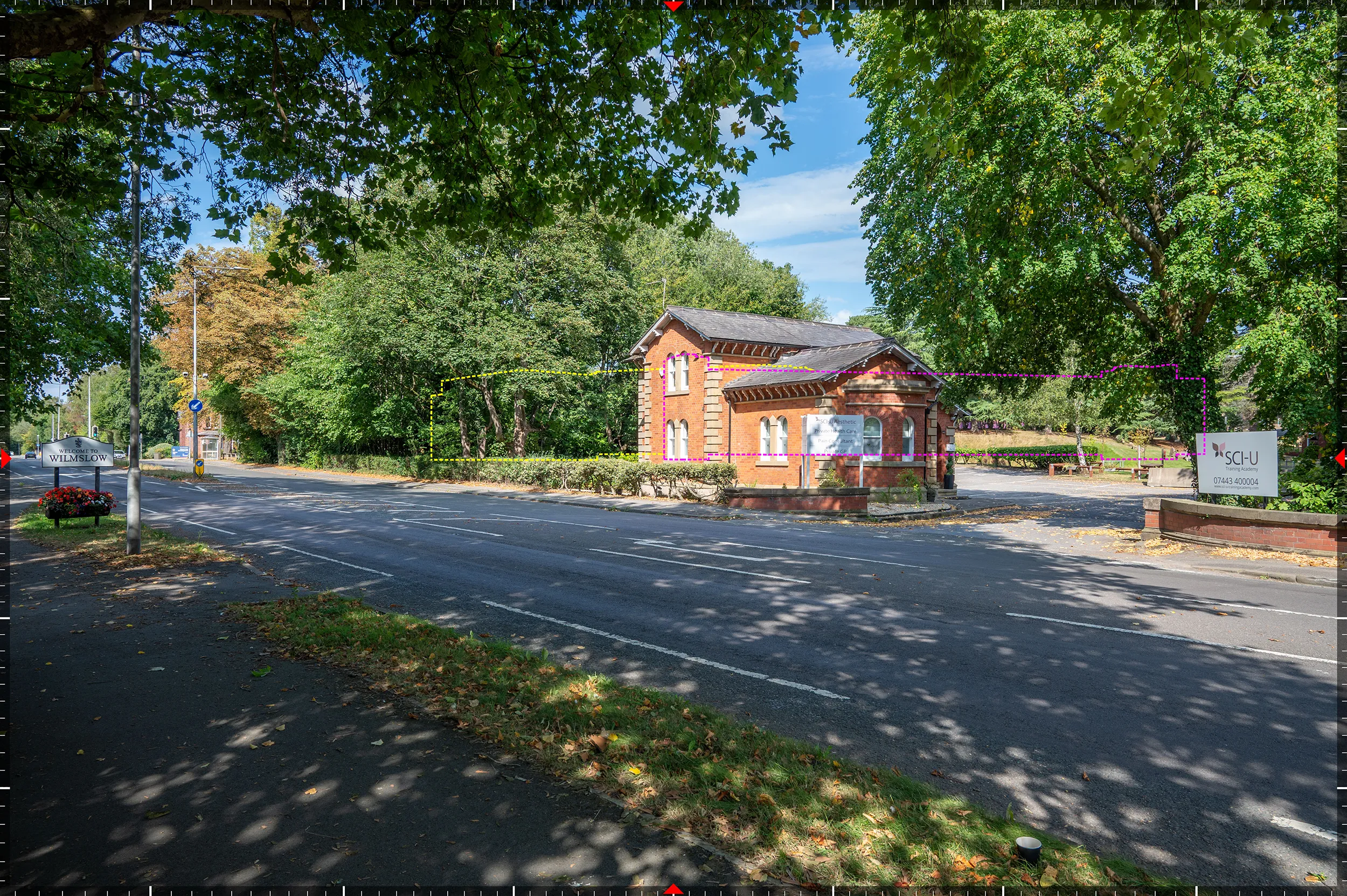
VP02, Alderley Road at the southern access, 192 metres out. A Level 1 wireline records where the buildings sit and how much of them reads through the trees.
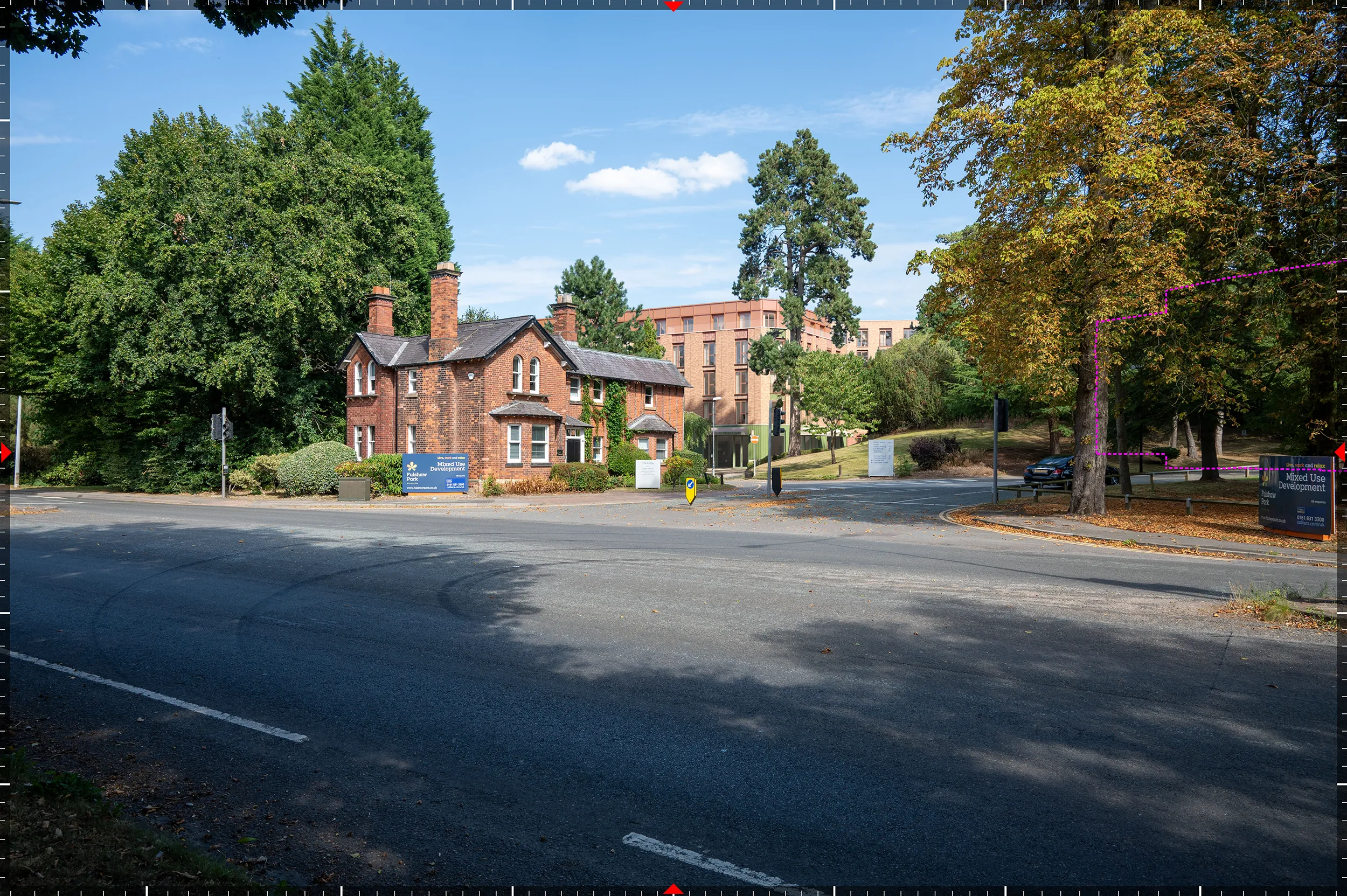
VP03, Alderley Road at the main access, rendered to AVR Level 3. At 143 metres this is the closest of the Alderley Road views and one of only two produced as renders.
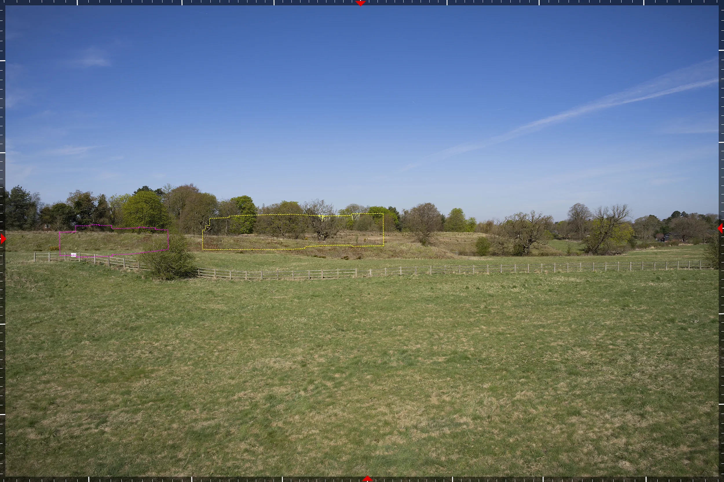
VP07, from the railway, 308 metres east and the most distant viewpoint in the set. Wireline at AVR Level 1.
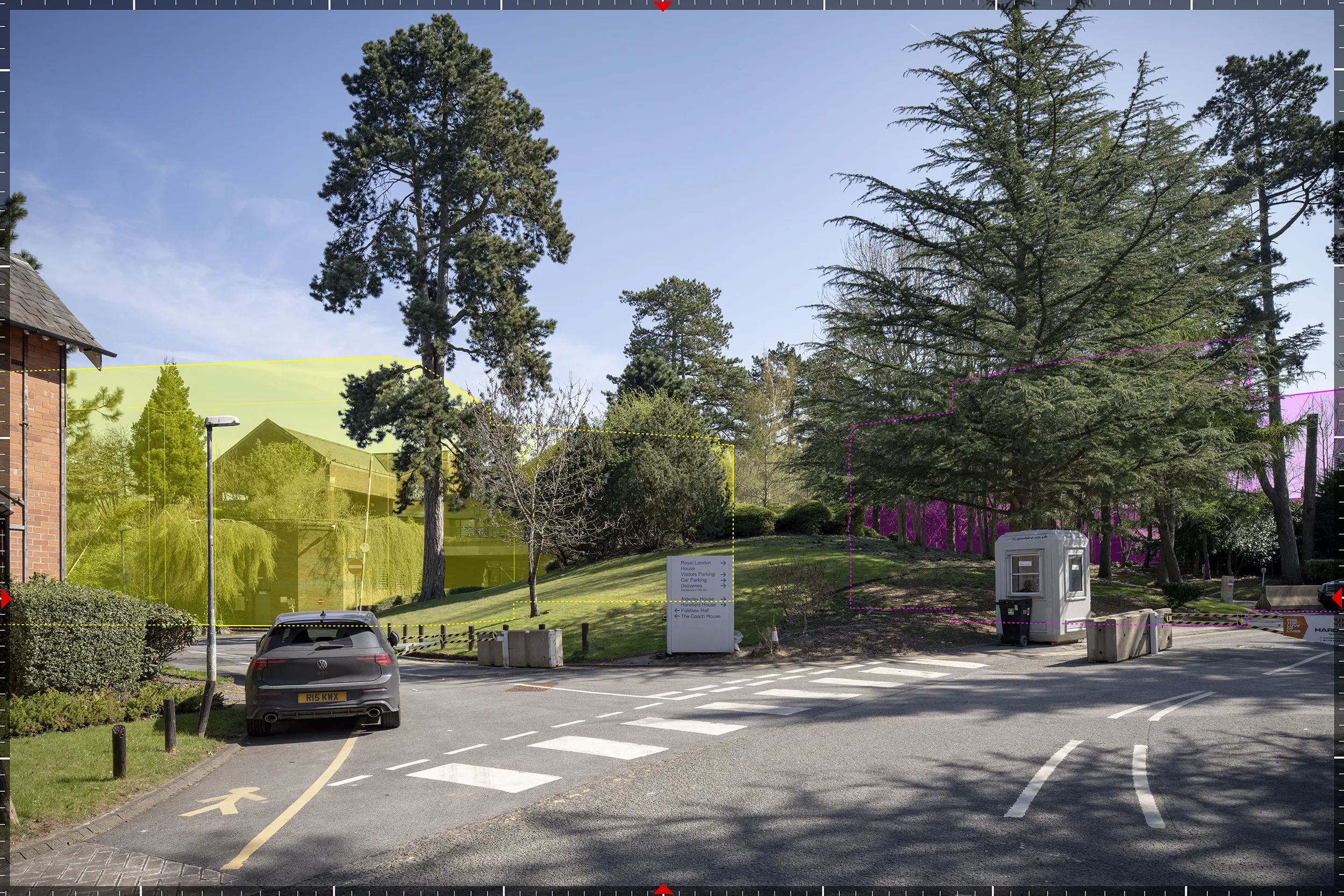
VP08, the site access beside the Northern Lodge, a locally listed building. 113 metres from the site centre, wireline at AVR Level 1.
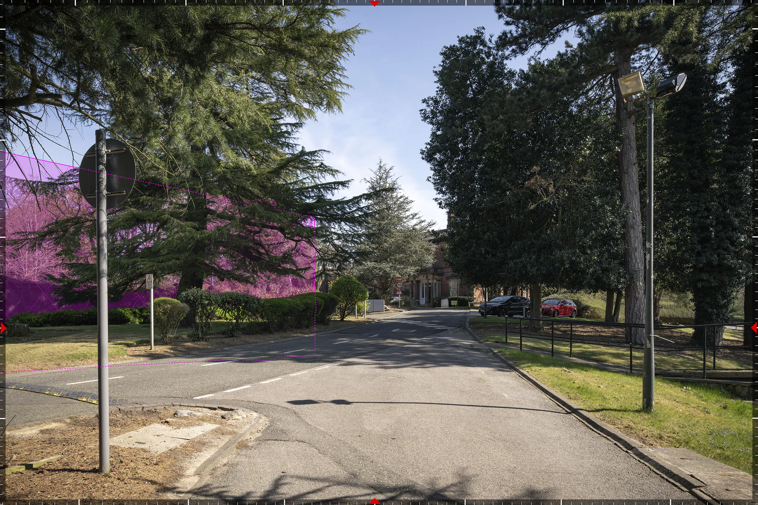
VP09, south of the multi-storey car park looking east. The closest viewpoint at 92 metres, and the one that tests the car park against Harefield House.
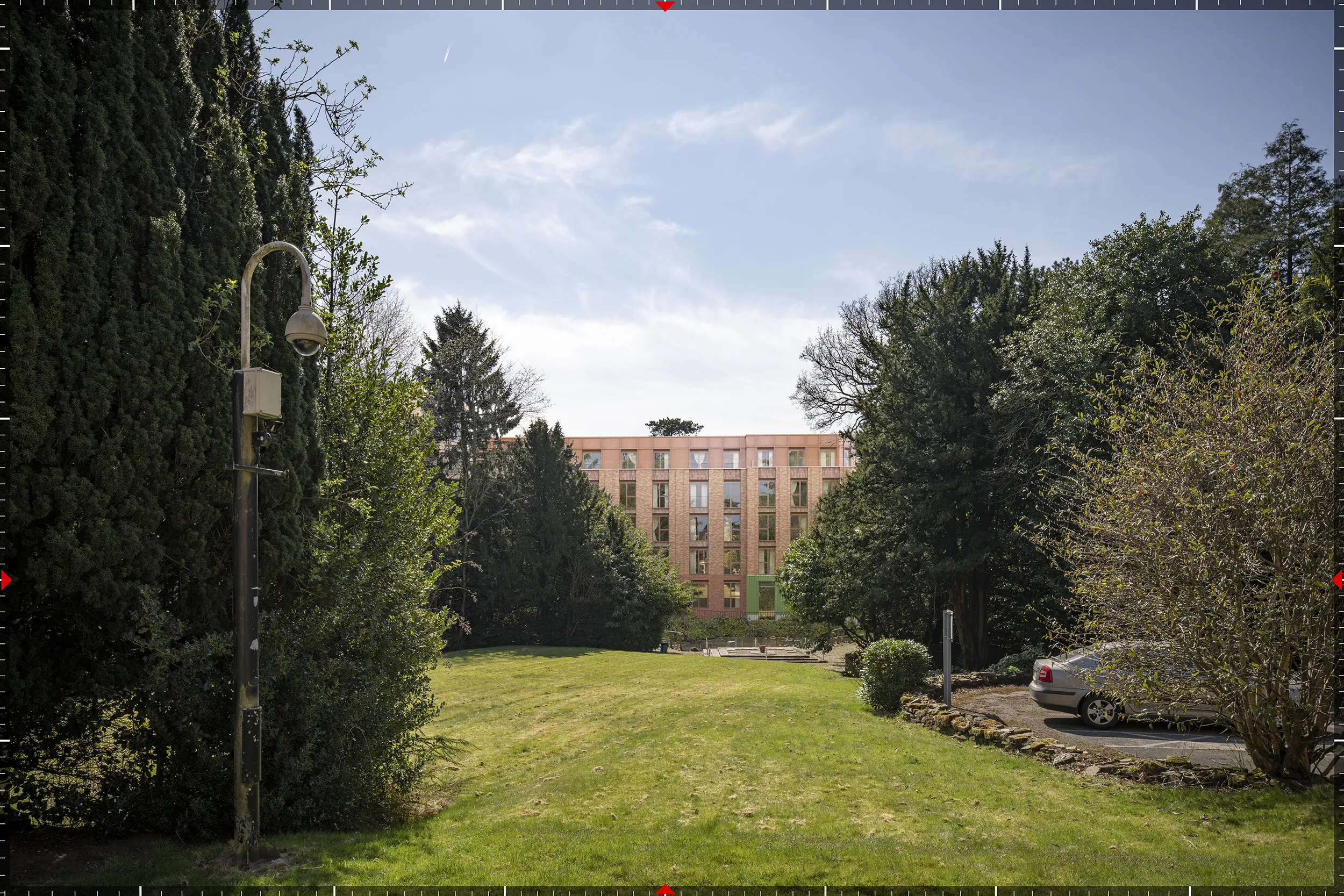
AVR Level 3 verified view south from FulshaVP10, south from Fulshaw Hall, 152 metres. Rendered at AVR Level 3: the view from the Grade II listed hall was one of the two the heritage assessment turned on.w Hall into the site, with the proposed courtyard buildings seen across the mature parkland.