Windsor Road
Slough SL1
Local Planning Authority
Slough Borough Council
Client
GKM Infra Slough LTD
Architects
FAL Architects
Consultants
Savills (Townscape & Heritage), Hybrid (Planning)
Visualisation Scope
7 AVR Level 1 (Wireline), 6 AVR Level 3 (Photorealistic Render)
Project Overview
Windsor Road and Albert Street meet at a corner of roughly 0.08 hectares in the middle of Slough's Square Mile. The site currently holds an electric vehicle charging station and car park, with the ten storey Crossways development along one side and the Urban Building, an eight storey office in glazed and green cladding, on the junction itself.
FAL Architects' scheme replaces both structures with a 14 storey building. The facing material is a mid tone grey brick, chosen to sit with the grey brickwork of Crossways and to stay recessive in the long views from Windsor. The proposal would deliver 90 homes with external balconies, commercial floorspace at ground level, landscaping and public realm improvements. The charging station is not lost in the process: it moves to the neighbouring Urban Building.
Two designated heritage assets sit close by, the Grade II* listed St Mary's Church and the Grade II listed Slough Town War Memorial in its churchyard, and the site falls within the wider setting of Windsor Castle. Eye-kon produced Accurate Visual Representations from eleven agreed viewpoints, forming the evidence base for the Townscape, Heritage and Visual Impact Assessment prepared by Savills.
This application sits alongside the redevelopment of the multi-storey car park site on Albert Street, assessed from the same agreed viewpoint framework.
Planning and Heritage Context
The application had to show compliance with the National Planning Policy Framework and the design policies adopted by Slough Borough Council. The THVIA assessed how a 14 storey building on this corner reads in the townscape, how it meets the public realm around it, and how it sits in the setting of the listed buildings nearby.
It also had to reach into Windsor Great Park. Slough falls within the wider setting of Windsor Castle, a Grade I listed building, so the assessment took in the East Terrace of the Castle and the Long Walk. In views of that length the question is rarely whether a building is attractive. It is whether it can be picked out at all, and whether it disturbs the primacy of what people came to look at. The choice of a grey, recessive brick answers a question asked from six kilometres away.
Eye-kon's Involvement
Eye-kon produced thirteen verified images across eleven agreed viewpoints, seven at AVR Level 1 and six at AVR Level 3. The two strategic Windsor views were produced at both levels, so a reader can move between a measured outline and a rendered image of the same frame.
The viewpoint framework was drawn once and used twice. Twelve positions were agreed across this site and the neighbouring multi-storey car park scheme on Albert Street. Because the two came forward as separate applications, each assessment carries the viewpoints relevant to its own site. Two of those positions, on Windsor Road and Chalvey Road East, show nothing of the car park site but do show this one, and they are among the eleven here.
Production Process
1 | Photography and survey
Baseline photography for the town centre viewpoints was shot on a full frame DSLR at a fixed eye level of 1.6 metres, timed for clear weather. Camera positions and ground control points were surveyed using a Leica Total Station and GNSS equipment, referenced to OSGB36, with control points spread deliberately through foreground, middle distance and background.
Windsor was handled differently. Photography inside the Castle grounds is tightly controlled, so the two strategic views use the approved camera locations and survey package issued by Slough Borough Council. That avoided further work on a sensitive site and kept the baseline consistent with imagery the authority had already accepted.
2 | 3D modelling and camera matching
The architectural model supplied by FAL Architects was positioned using Ordnance Survey coordinates and checked against the surveyed framework, with the highest point of the proposal at +74.5 metres above Ordnance Datum.
Working at full Ordnance Survey coordinate values introduces floating point drift in 3ds Max, so the scene origin was moved to a local reference point. Virtual cameras were rebuilt to match the lenses used on site, a 24 mm tilt shift for the street level views and a 50 mm for the two strategic ones, then aligned to the surveyed control points using camera matching and parallax analysis.
3 | Material and lighting calibration
Lighting was reconstructed with the V-Ray Sun and Sky system, set to the site's latitude and longitude and to the date and time recorded for each photograph, so the shadows in the model fall where the shadows in the photograph fall. Materials were developed from the architect's specification, principally the mid tone grey brickwork and the balcony balustrades.
The two Windsor views needed one further step. At that distance a photograph carries atmospheric depth that a clean render does not, so a light volumetric haze was introduced and calibrated against the baseline, kept deliberately short of anything that would alter how large, how near or how visible the building appears.
4 | Verified view production
The final images were composited in Adobe Photoshop, following Landscape Institute Technical Guidance Note 06/19 and the London View Management Framework. The Level 1 wirelines answer the first question, which is where the building is and how much of it can be seen. The Level 3 renders answer the second, which is what it is made of and how it settles into the street.
Where cumulative effects were relevant, the consented but unbuilt schemes at Queensmere, The Future Works and Station Square were added as red wireline overlays, built from published planning information and placed in the same coordinate framework.
Every image carries graticules at 10 and 1 degree increments and a marked optical axis. Camera locations, heights and reference data have been kept, so any view in the set can be revisited and checked.
Technical Summary
Parameter | Project Specifications |
Site Location | Corner of Albert Street and Windsor Road, Slough, SL1 2NE |
Proposal | 14 storey mixed use building delivering 90 homes with ground floor commercial space, replacing an electric vehicle charging station and car park |
Client | GKM Infra Slough LTD |
Architect | FAL Architects (Francis Architects Limited) |
Townscape, Heritage and Visual | Savills |
Planning | Hybrid |
Highest Point AOD | +74.5 m AOD |
Total Viewpoints Assessed | 11 agreed viewpoints, drawn from a 12 position framework shared with the neighbouring Albert Street scheme |
AVR Deliverable Levels | Level 1 (Wireline), Level 3 (Photorealistic Render) |
Key Heritage Receptors | St Mary's Church (Grade II*), Slough Town War Memorial (Grade II), Windsor Castle (Grade I) |
Technical Guidance | LI TGN 06/19, London View Management Framework |
The Verified Views: Eleven Agreed Viewpoints
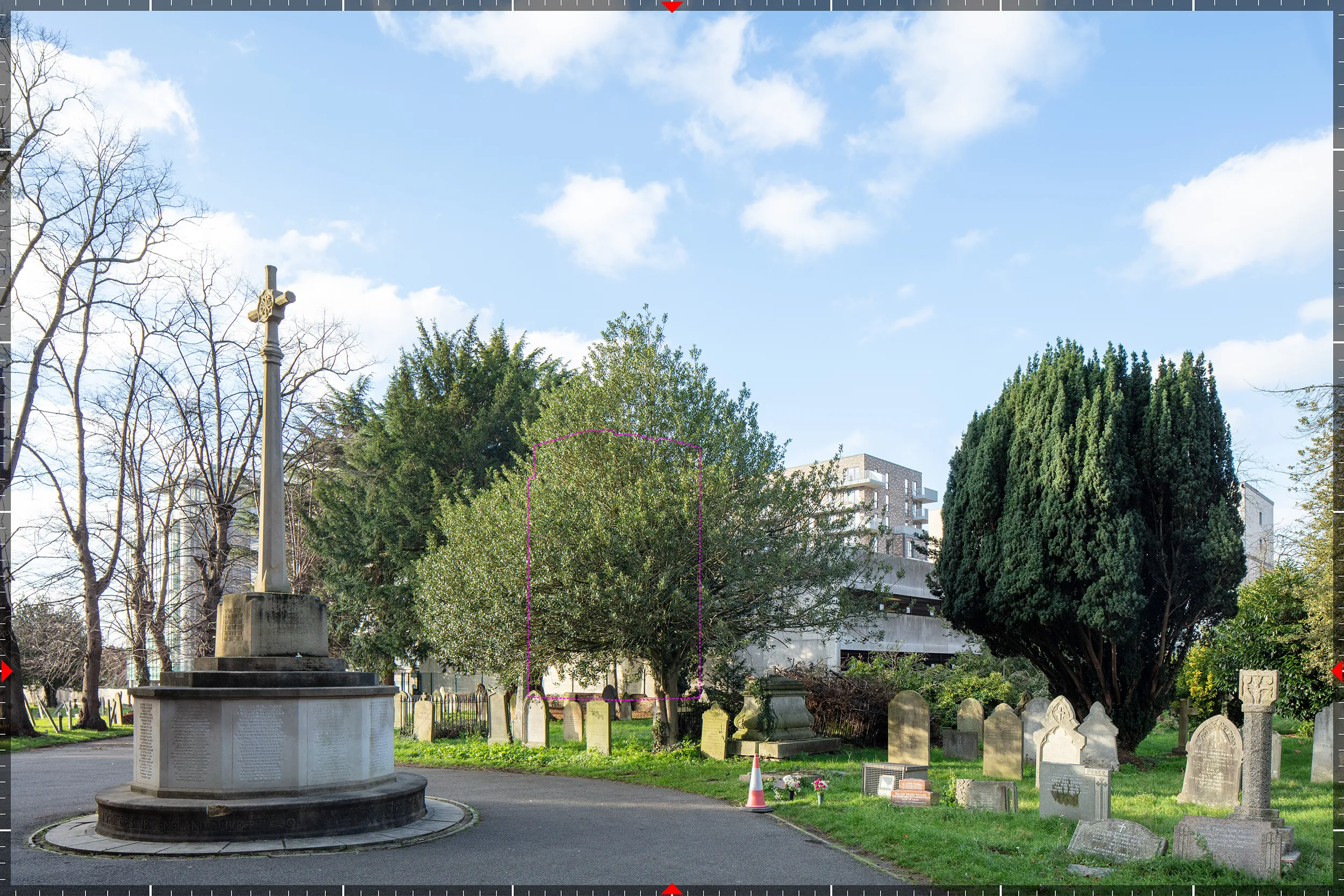
View 1, St Mary's Churchyard looking west. Wireline at AVR Level 1, taken beside the Grade II* listed church and the war memorial in its grounds.
View 2, Osborne Street looking west. AVR Level 1: a wireline records position and extent without interpreting materials.

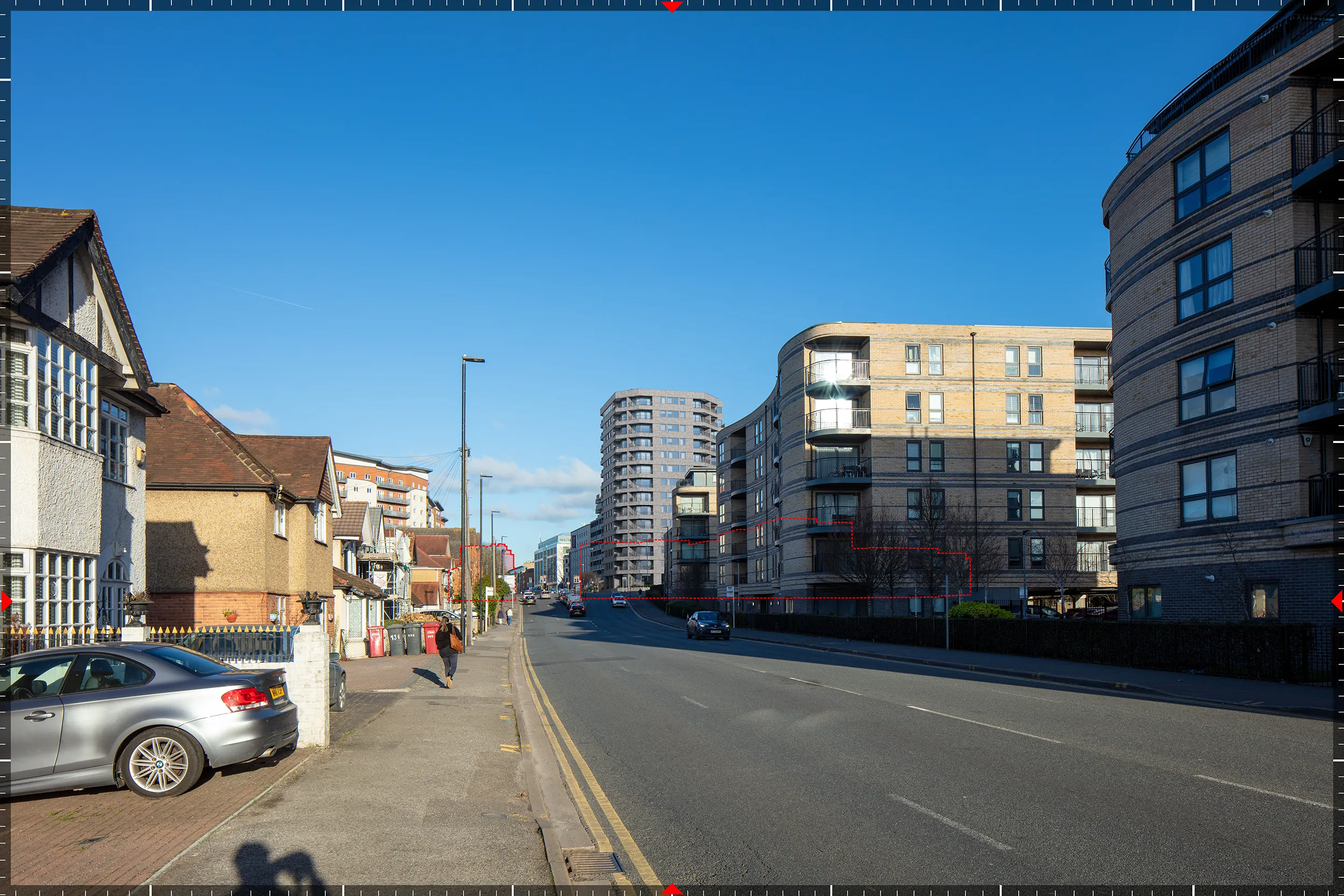
View 3B, Windsor Road just south of Chalvey Park, fully rendered at AVR3. The mid tone grey brick is read here against the grey brickwork of Crossways opposite.
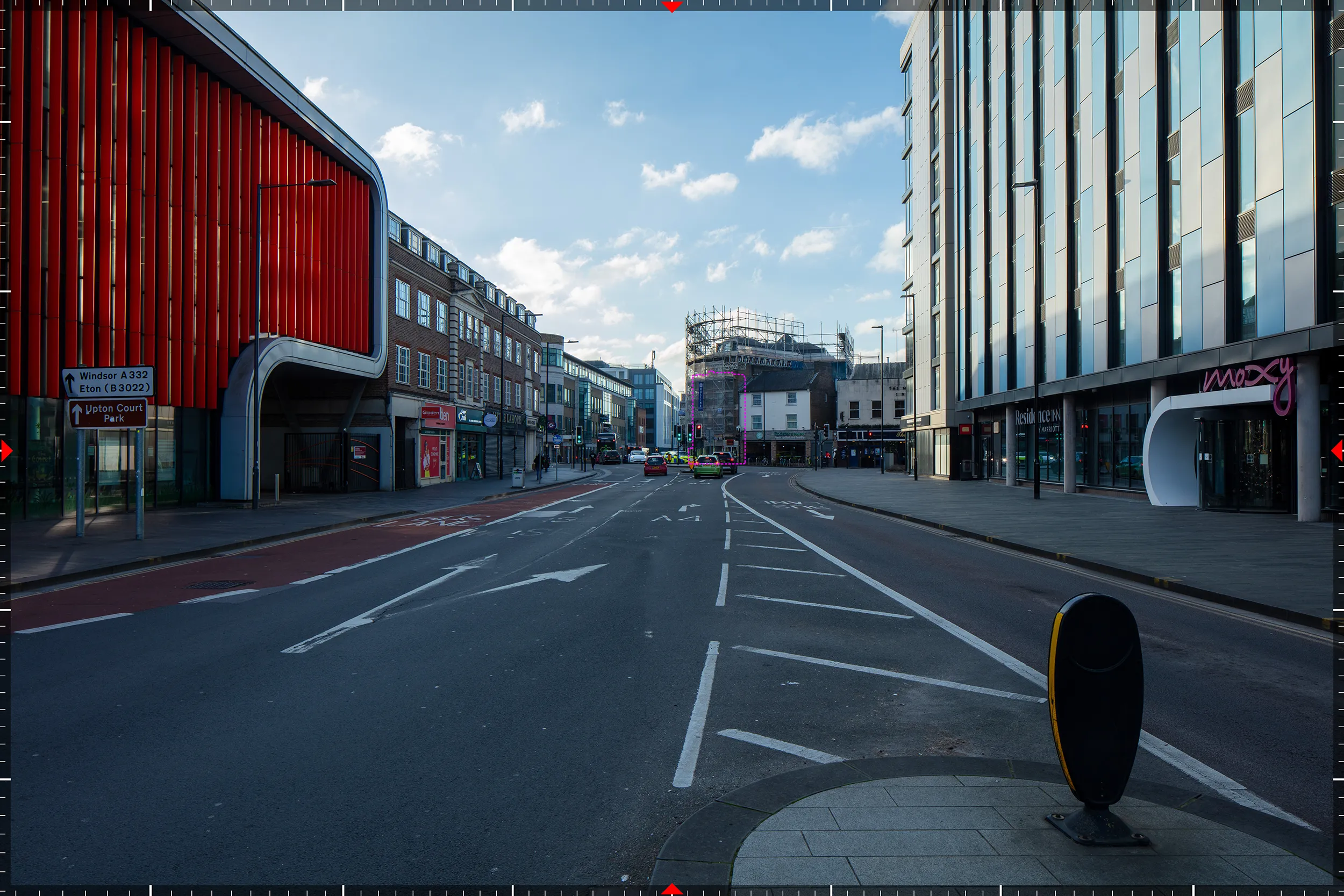
View 4, William Street looking south. The most distant of the town centre wirelines.
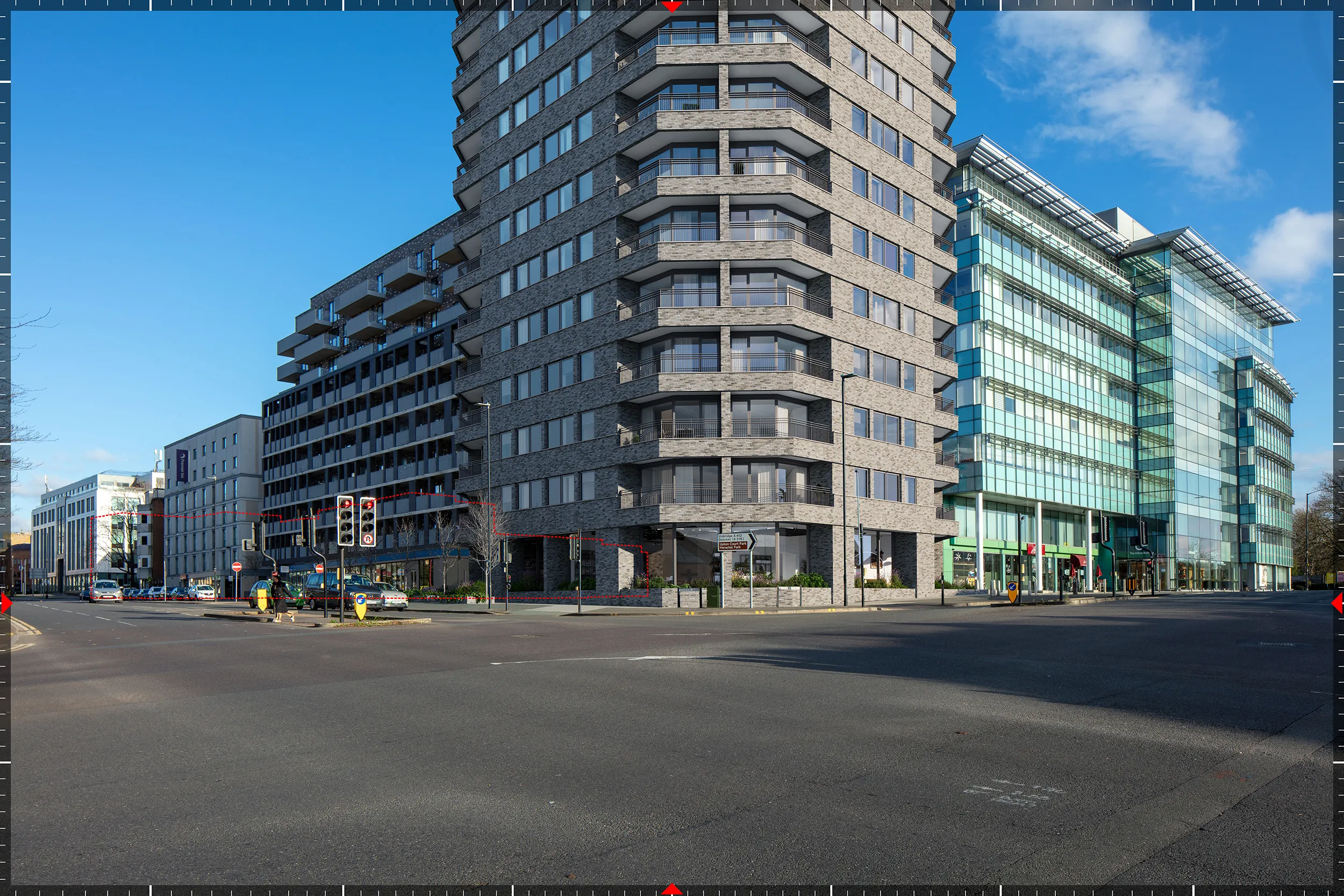
View 5, Windsor Road at Chalvey Road East, rendered to AVR Level 3.
View 6, Windsor Road, AVR Level 3. One of two positions scoped out of the neighbouring car park assessment for having no view of that site, and carried into this one.
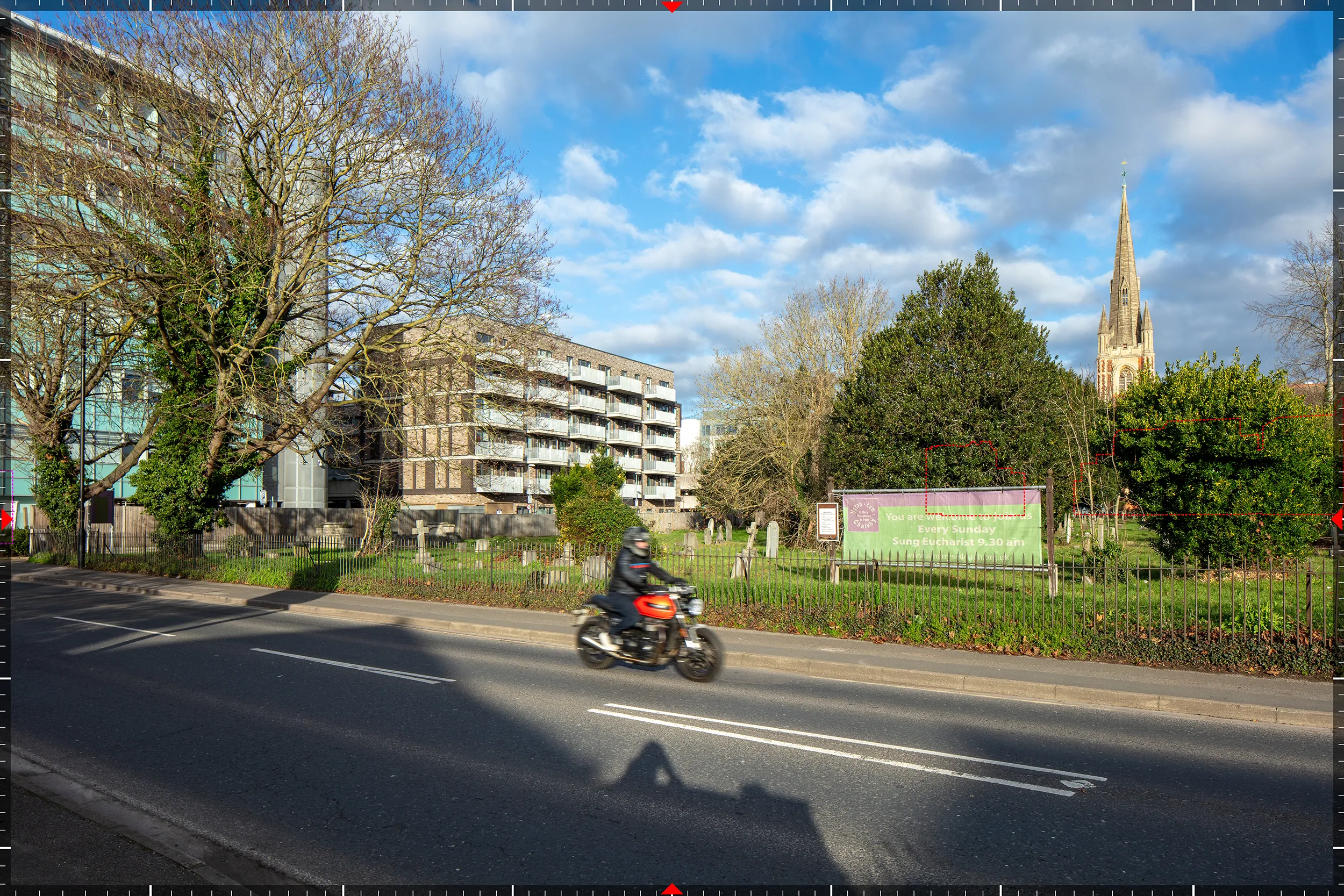
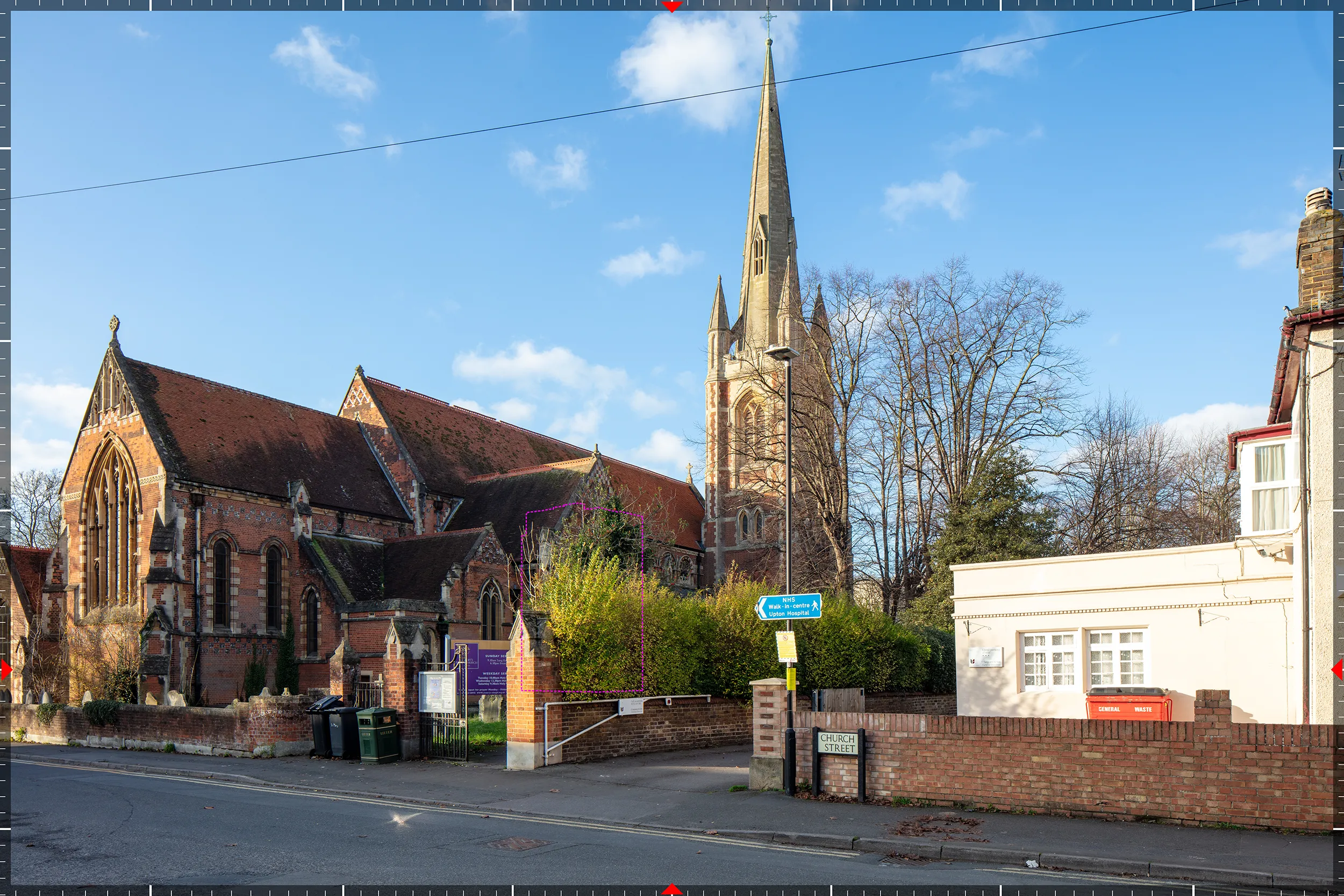
View 8, Albert Street at Church Street, looking north past St Mary's Churchyard. Wireline at Level 1.
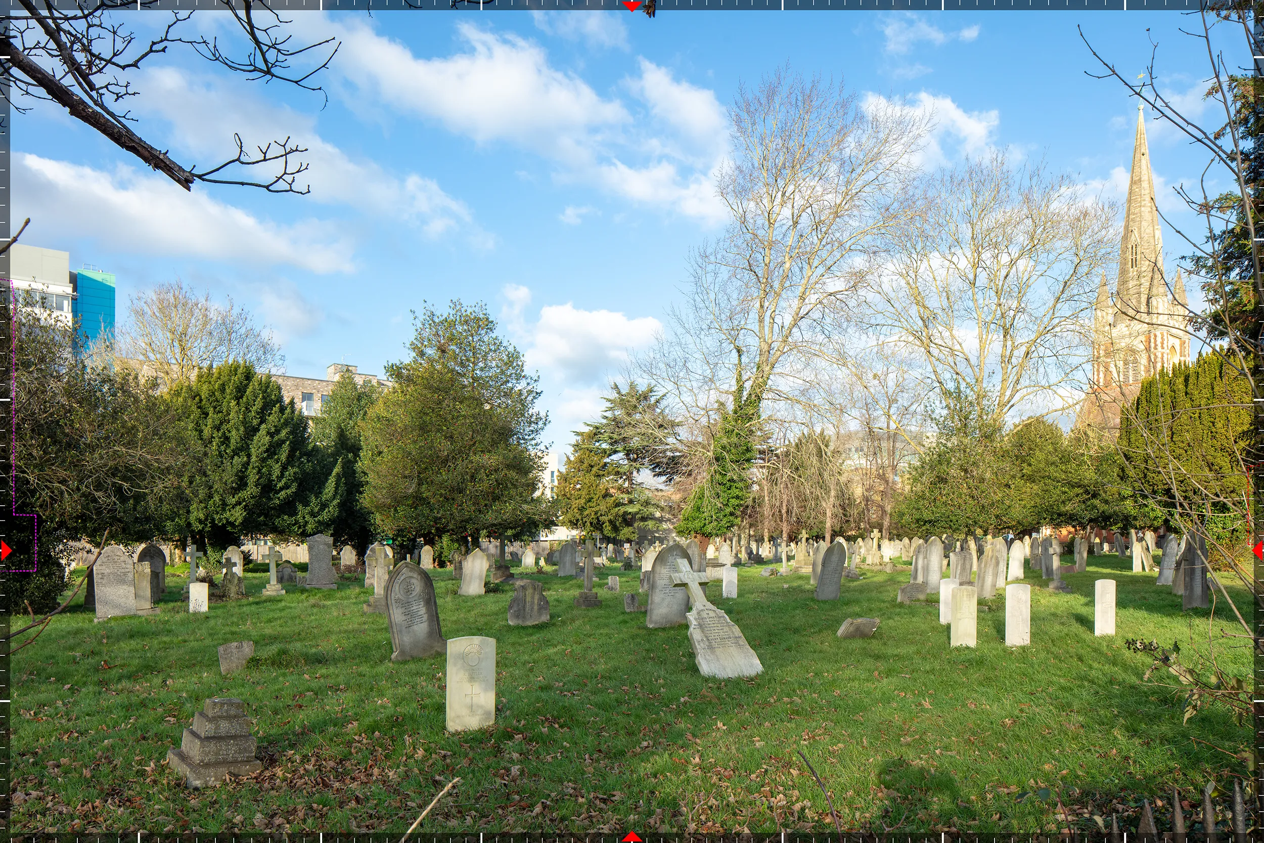
View 9, Church Street looking north west past the St Mary's Church group. AVR Level 1.

View 10, Chalvey Road East. Rendered at AVR Level 3, and the second of the two positions that show nothing of the neighbouring car park site but do show this one.
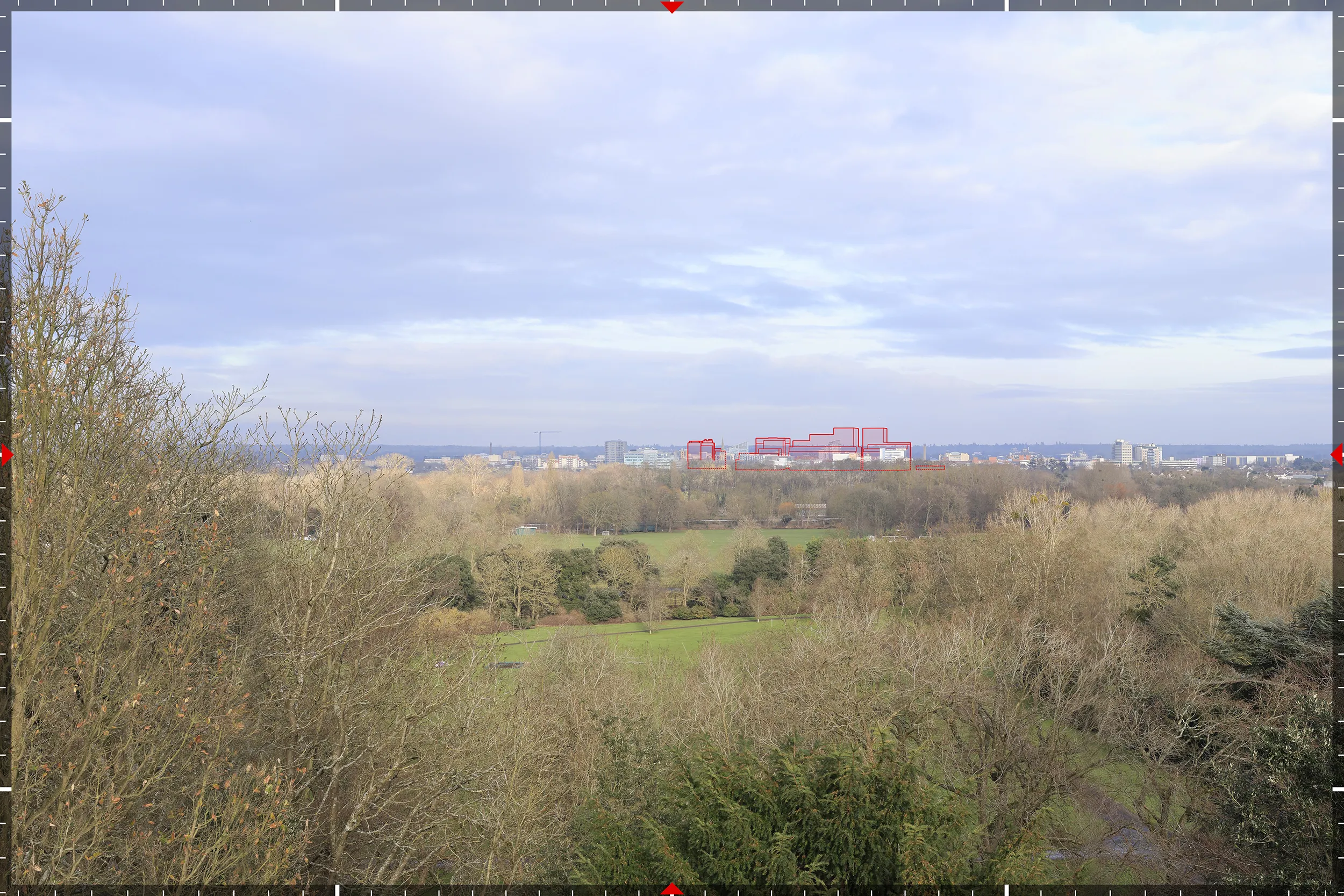
View 11, the East Terrace of Windsor Castle. Produced at both AVR Level 1 and Level 3, using the baseline photography issued by the council.
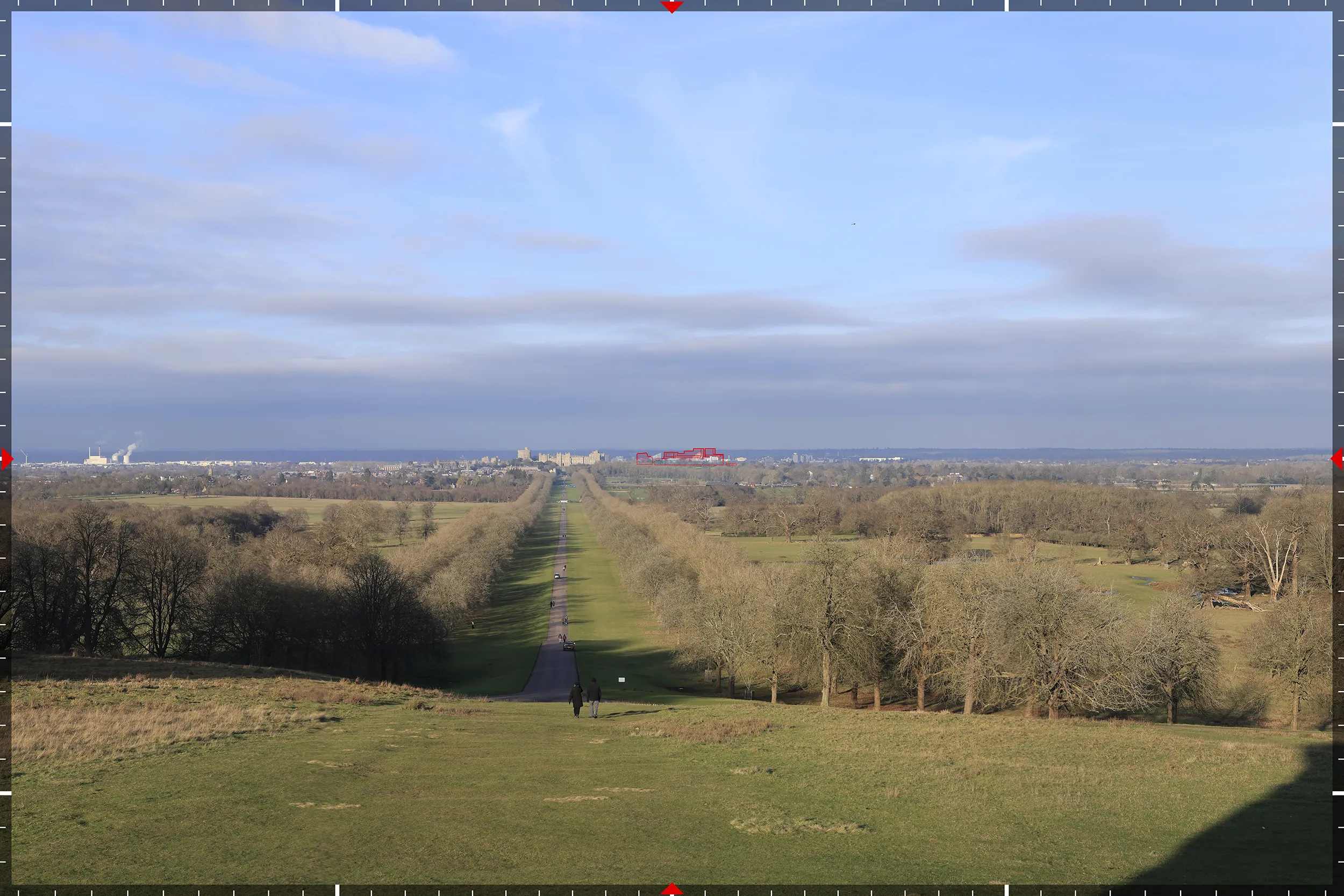
View 12, the Long Walk, at both levels. At this distance the brick tone does the work, and the grey was chosen to stay recessive in precisely this view.